


Sold
This object is eligible for a Certificate of BADA Provenance
The BADA Standard
- Since 1918, BADA has been the leading association for the antiques and fine art trade
- Members are elected for their knowledge, integrity and quality of stock
- Our clients are protected by BADA’s code of conduct
- Our dealers’ membership is reviewed and renewed annually
- Bada.org is a non-profit site: clients deal directly with members and they pay no hidden fees
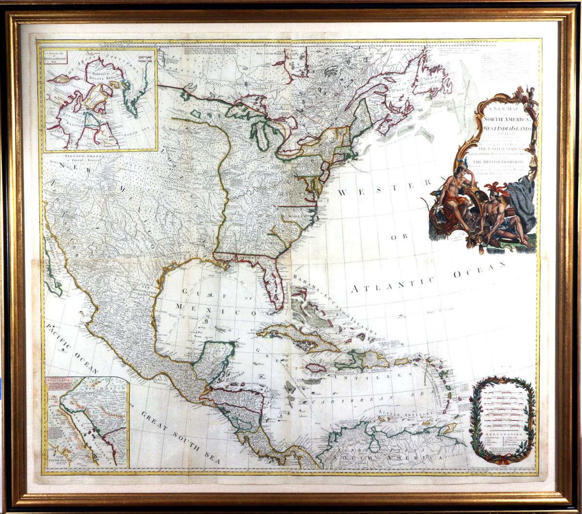
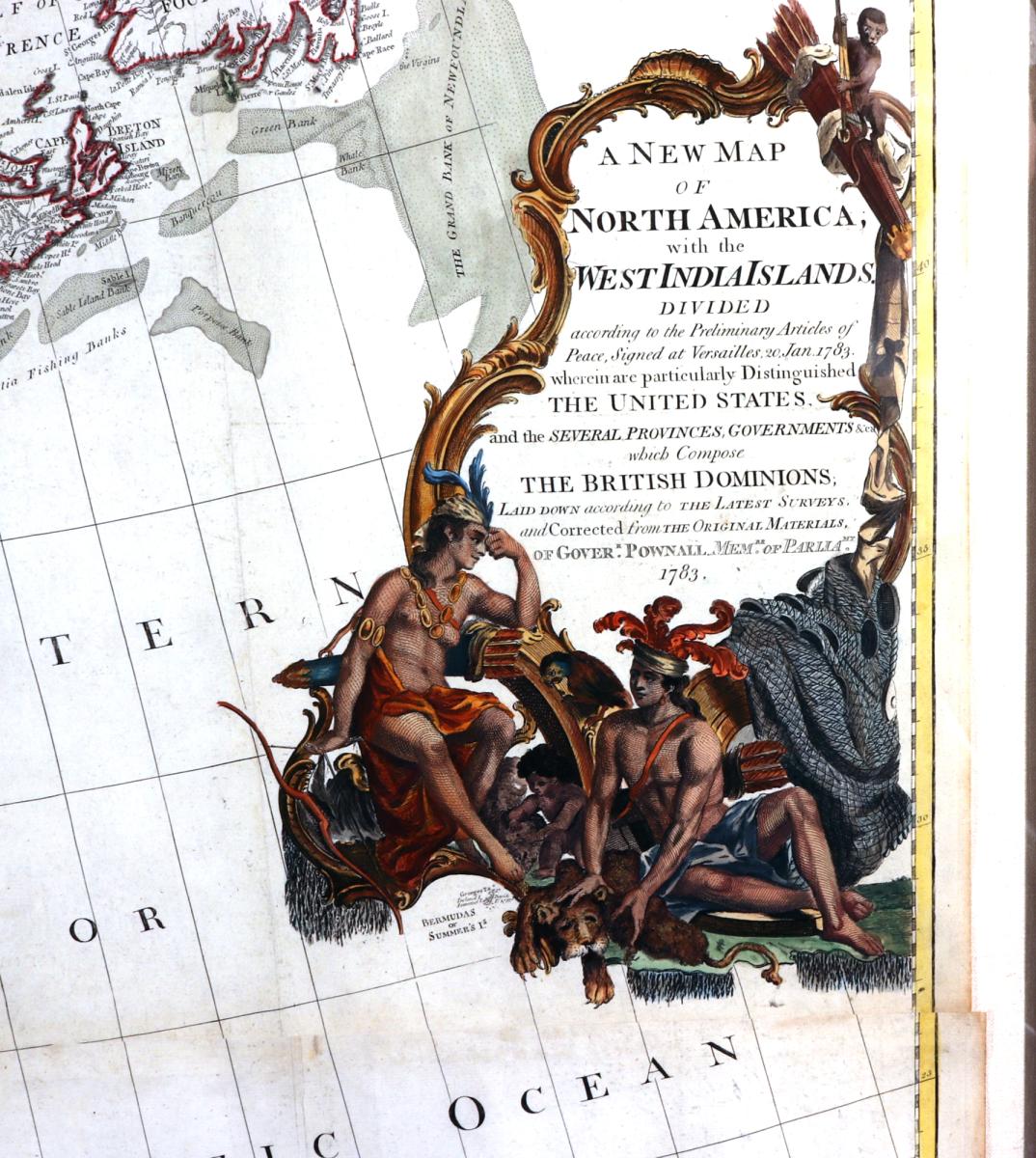
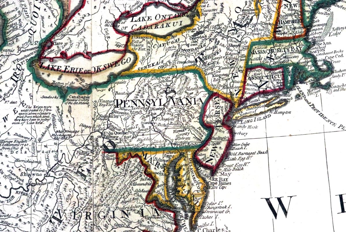
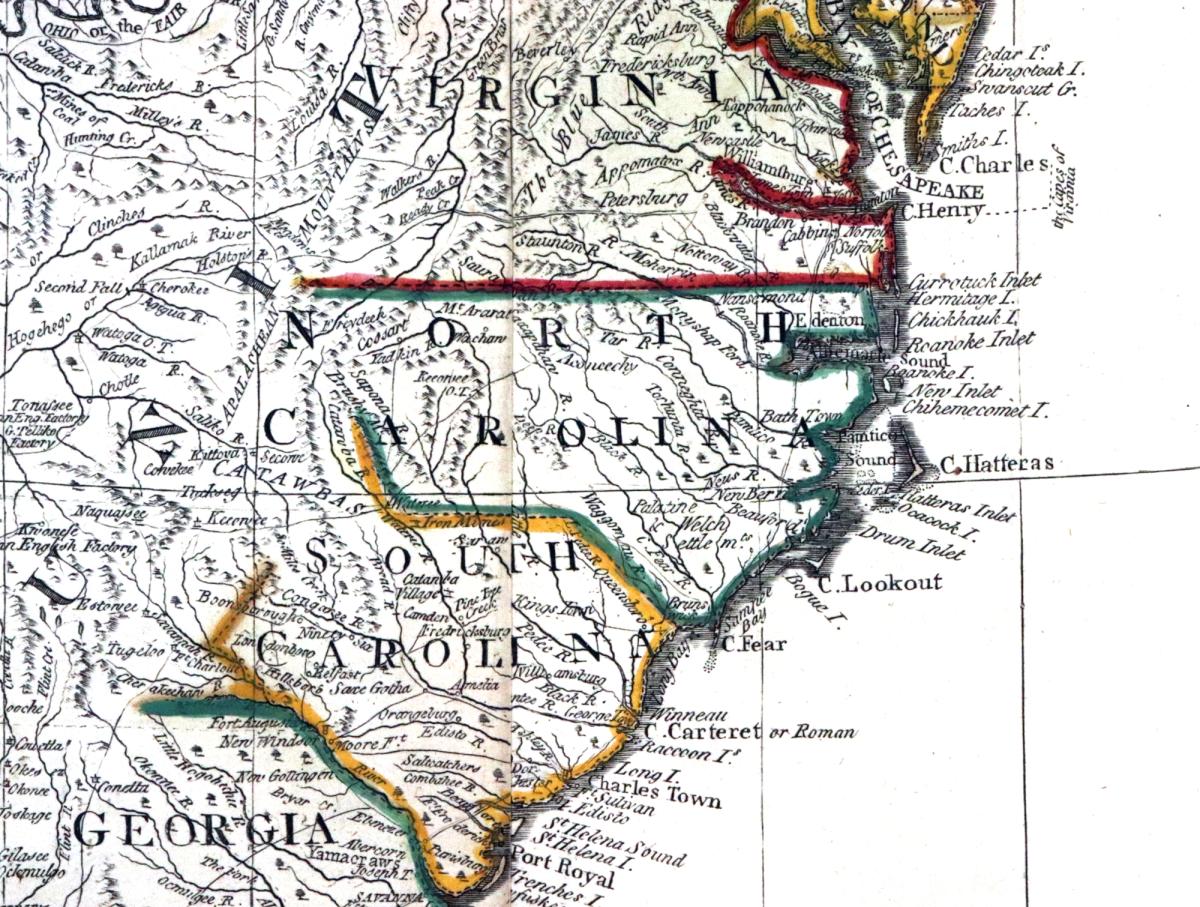
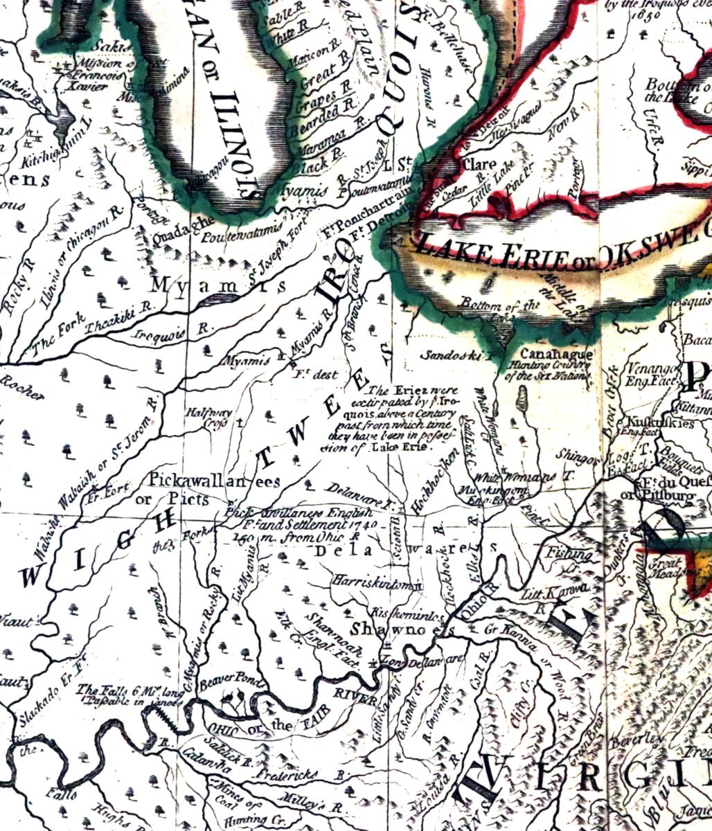
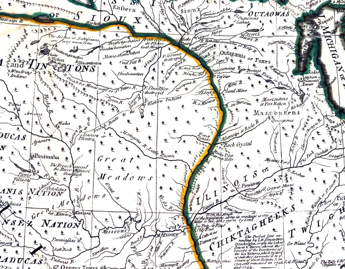
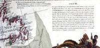
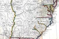
"A New Map of North America, with the West India Islands...according to the latest surveys, and corrected from the original materials, of Goverr. Pownall, Member of Parliamt,".
Printed for Robert Sayer, Map, Chart & Printmaker, No. 53 Fleet Street, London, as the Act Directs August 15, 1786.
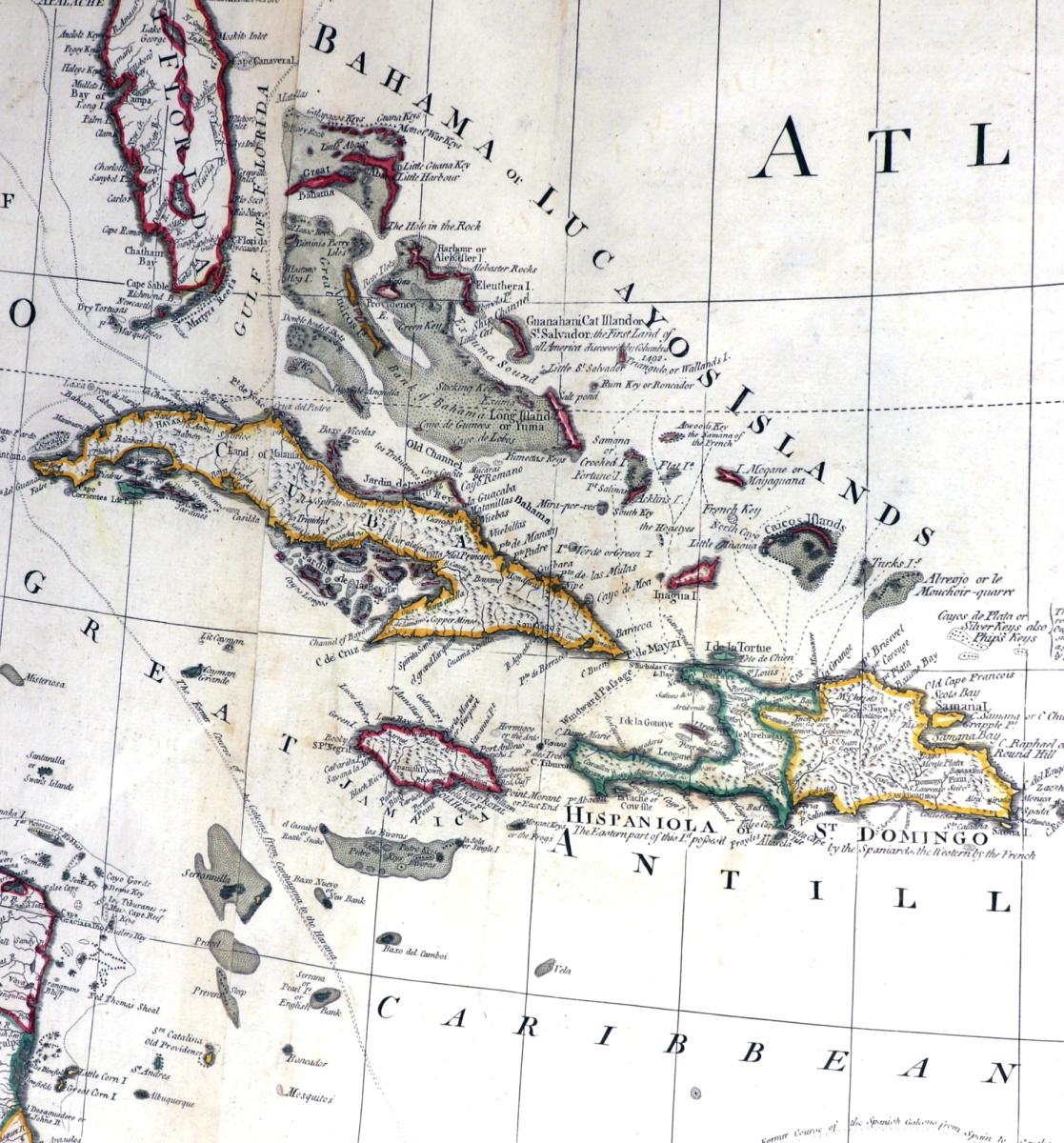
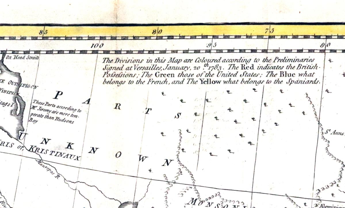
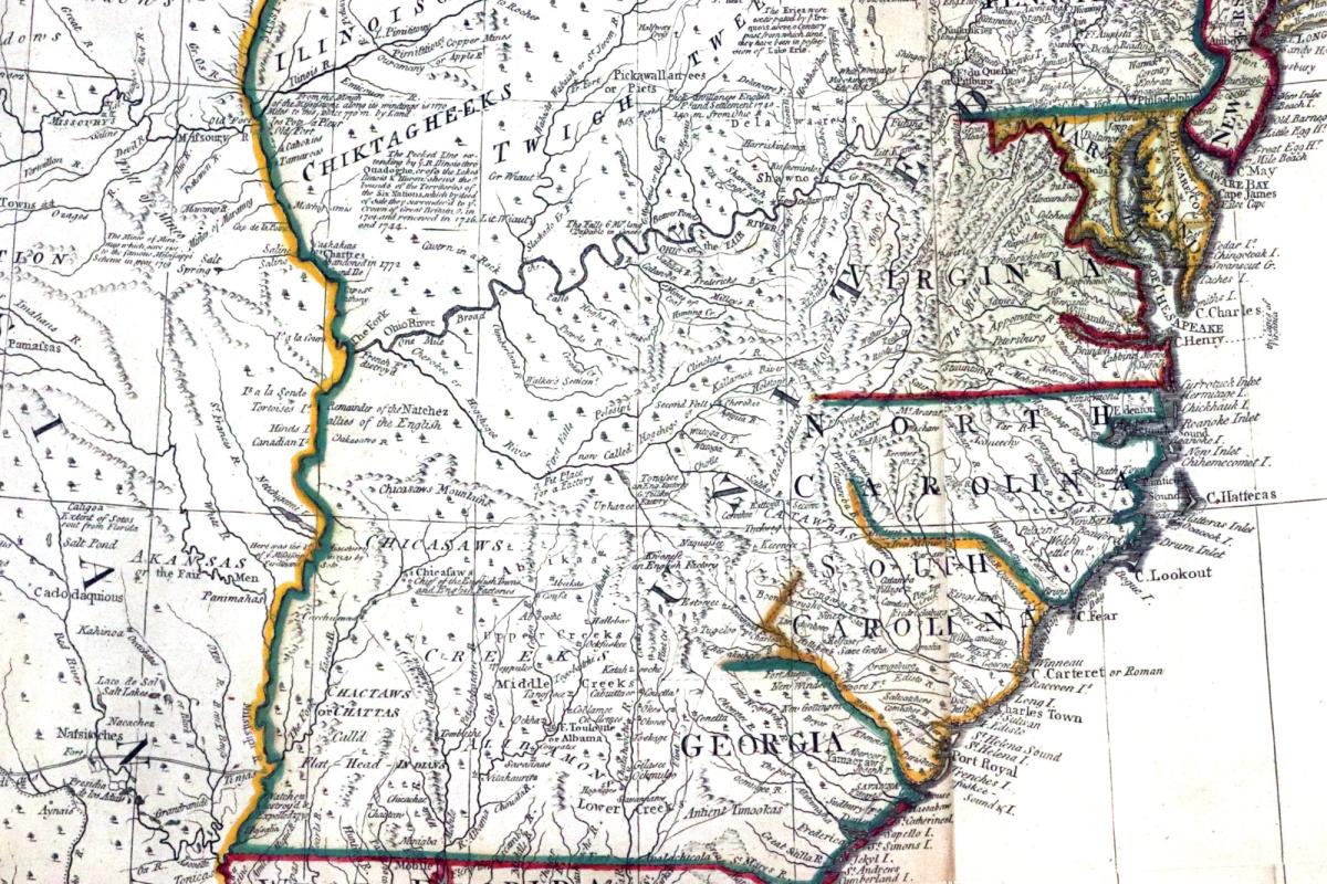
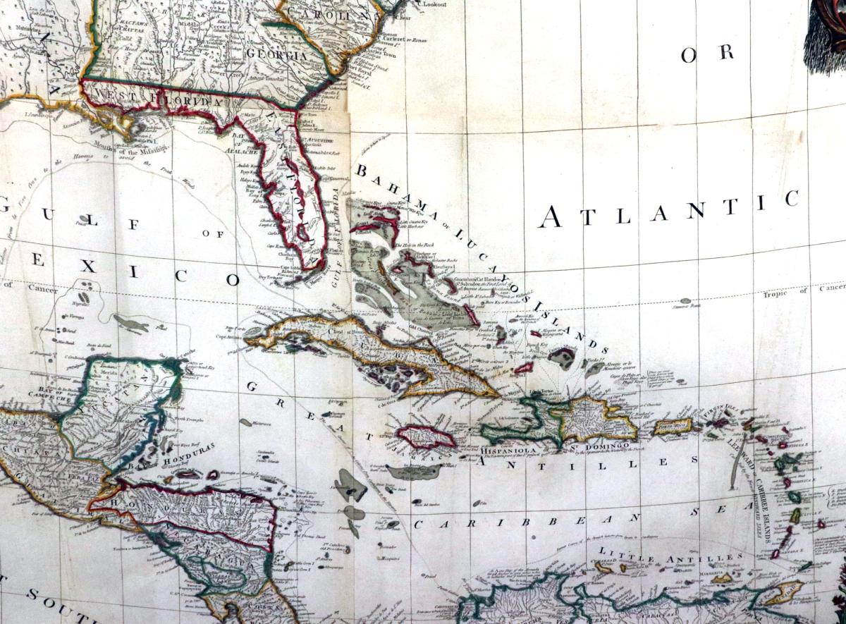
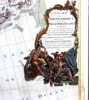
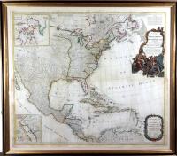
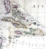
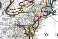
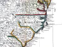
The monumental hand colored framed map on four sheets is titled "A New Map of North America, with the West India Islands. Divided according to the preliminary articles of peace, signed at Versailles, 20, Jan. 1783. wherein are particularly distinguished the United States, the several provinces, governments &ca which compose the British Dominions; laid down according to the latest surveys, and corrected from the original materials, of Goverr. Pownall, Member of Parliamt," The title cartouche includes a Native American family amidst furs, a parrot, and a monkey.
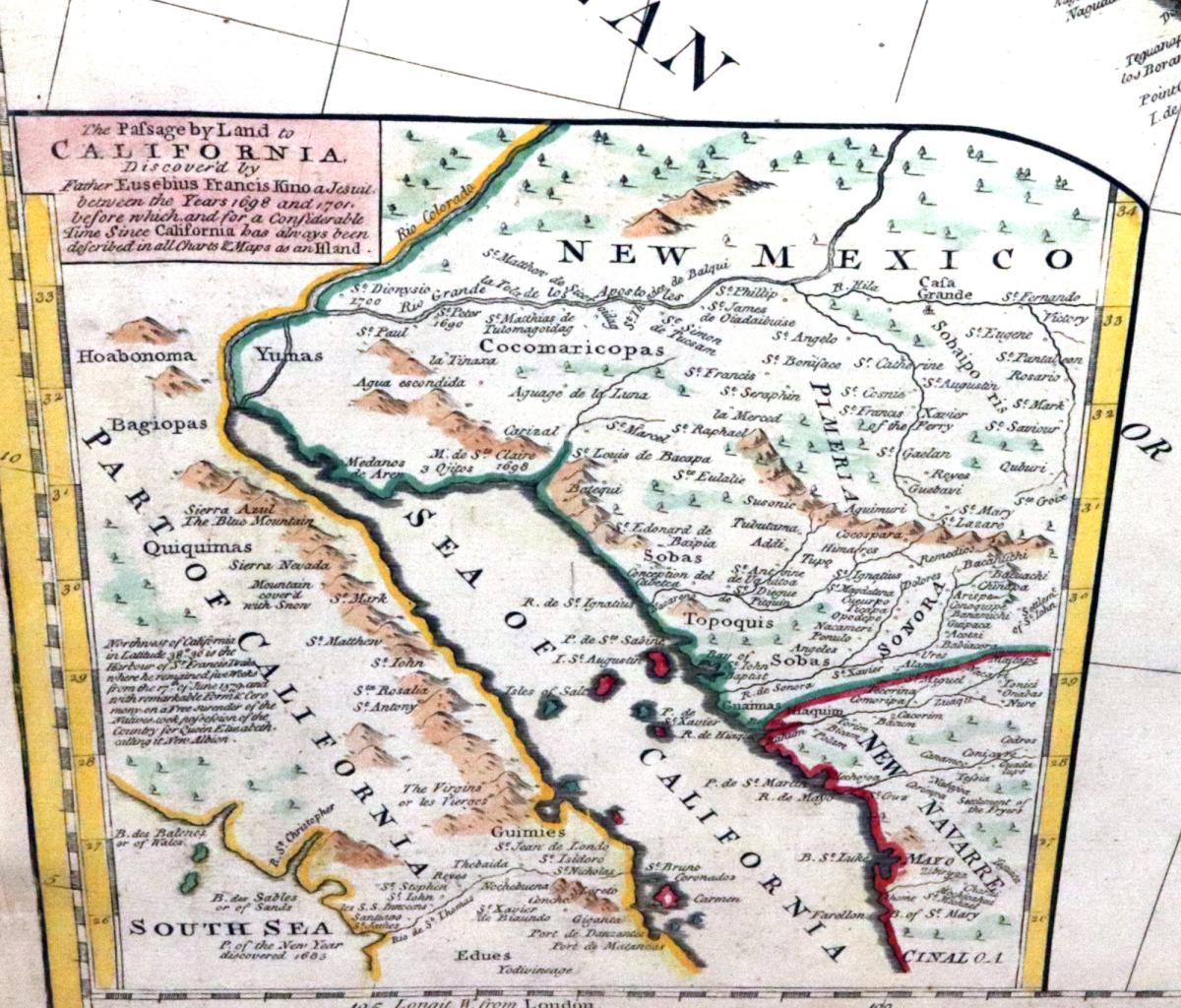
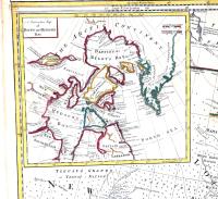
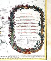
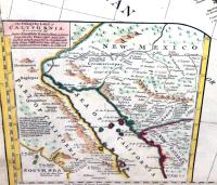
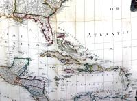
"The passage by land to California, discover'd by Father Eusebius Francis Kino, a Jesuit; between the years 1698 and 1701, before which, and for a considerable time since California has always been described in all charts & maps as an island."
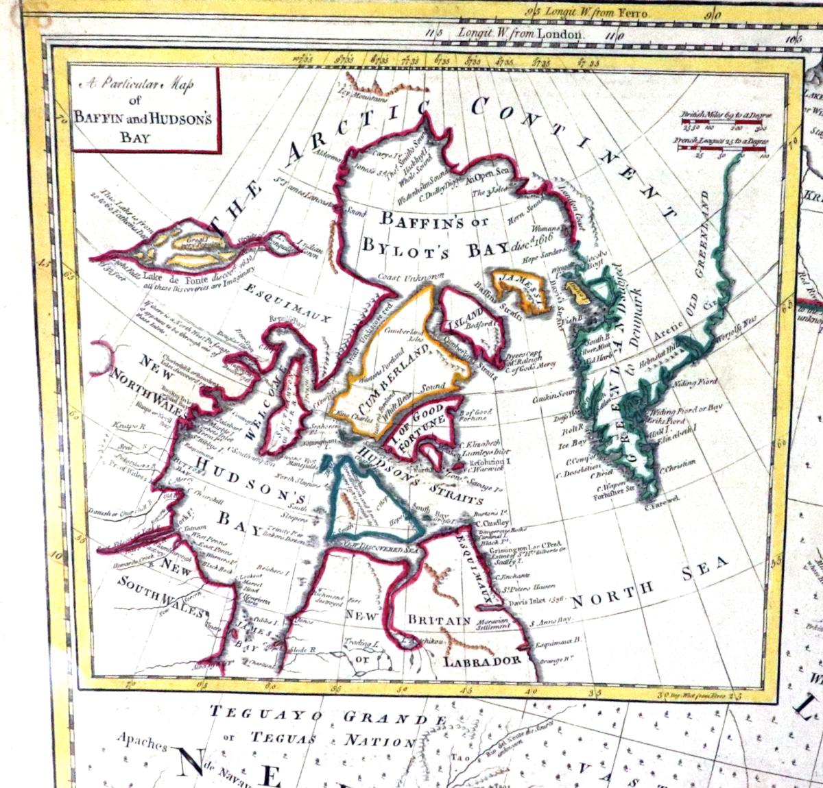
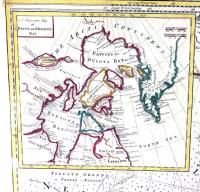
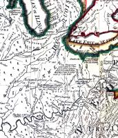
There is an insert to the top left of A particular map of Baffin and Hudson's Bay and to lower right, "The passage by land to California, discover'd by Father Eusebius Francis Kino, a Jesuit; between the years 1698 and 1701, before which, and for a considerable time since California has always been described in all charts & maps as an island."
Dimensions: Frame: 47 1/2 inches high x 53 inches wide
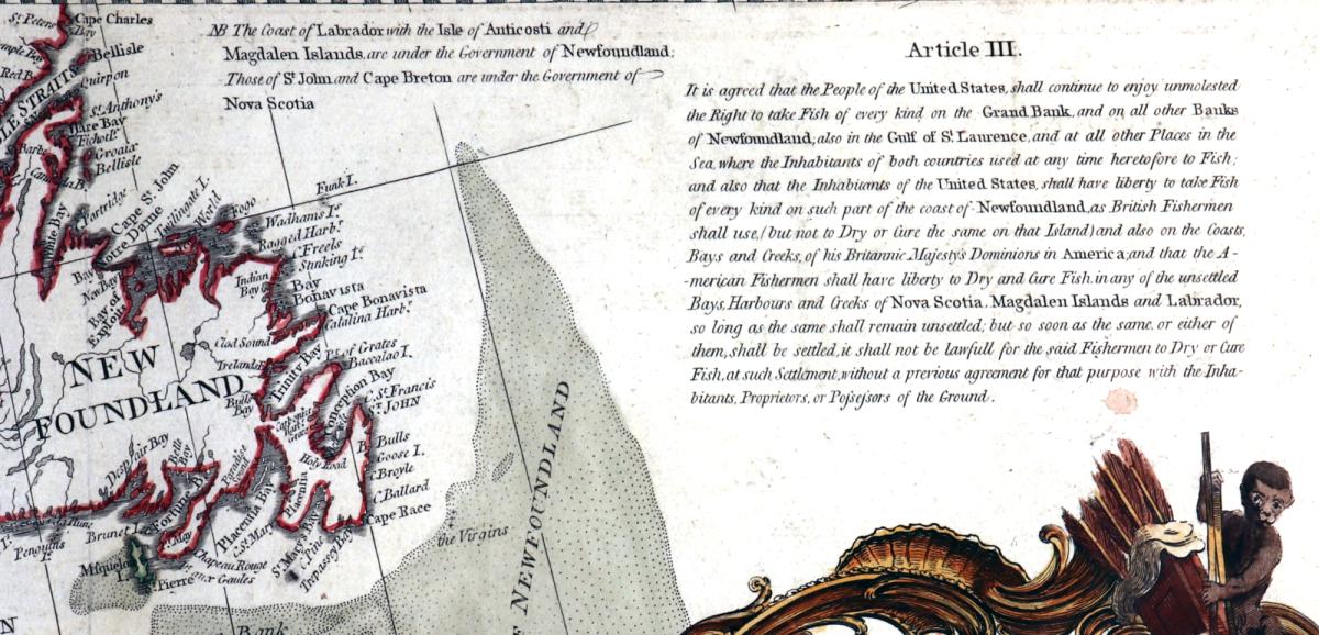
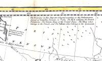
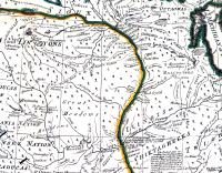
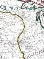
The map was originally published in 1755 and subsequently updated numerous times as more land was explored and land ownership changed. This example is dated 1786. It includes text at the top right corner setting forth the fishing rights of the United States. The lower left corner contains an insert is entitled: “A Passage By Land to California.” An upper left corner insert is entitled: “A Particular map of Baffin and Hudson’s Bay.” Extensive comments by Pownall regarding the lands and territories between the Apalachean (sic) Mountains and the Mississippi River regarding indigenous tribes, sites suitable for factories, alliances and temperaments of tribes and the navigability of river systems.
The map was printed for Saver and Bennett in London “as the Act directs” on August 15, 1783.
See example at The New York Public Library
(https://digitalcollections.nypl.org/items/510d47da-f0e1-a3d9-e040-e00a18064a99)
also The Library of Congress
(https://www.loc.gov/item/74693113/)
(Ref: VM98513)
Dimensions
120.65cm high x 134.62cm wideStock number
VM98513The BADA Standard
- Since 1918, BADA has been the leading association for the antiques and fine art trade
- Members are elected for their knowledge, integrity and quality of stock
- Our clients are protected by BADA’s code of conduct
- Our dealers’ membership is reviewed and renewed annually
- Bada.org is a non-profit site: clients deal directly with members and they pay no hidden fees