

Price
£1500.00This object is eligible for a Certificate of BADA Provenance
The BADA Standard
- Since 1918, BADA has been the leading association for the antiques and fine art trade
- Members are elected for their knowledge, integrity and quality of stock
- Our clients are protected by BADA’s code of conduct
- Our dealers’ membership is reviewed and renewed annually
- Bada.org is a non-profit site: clients deal directly with members and they pay no hidden fees
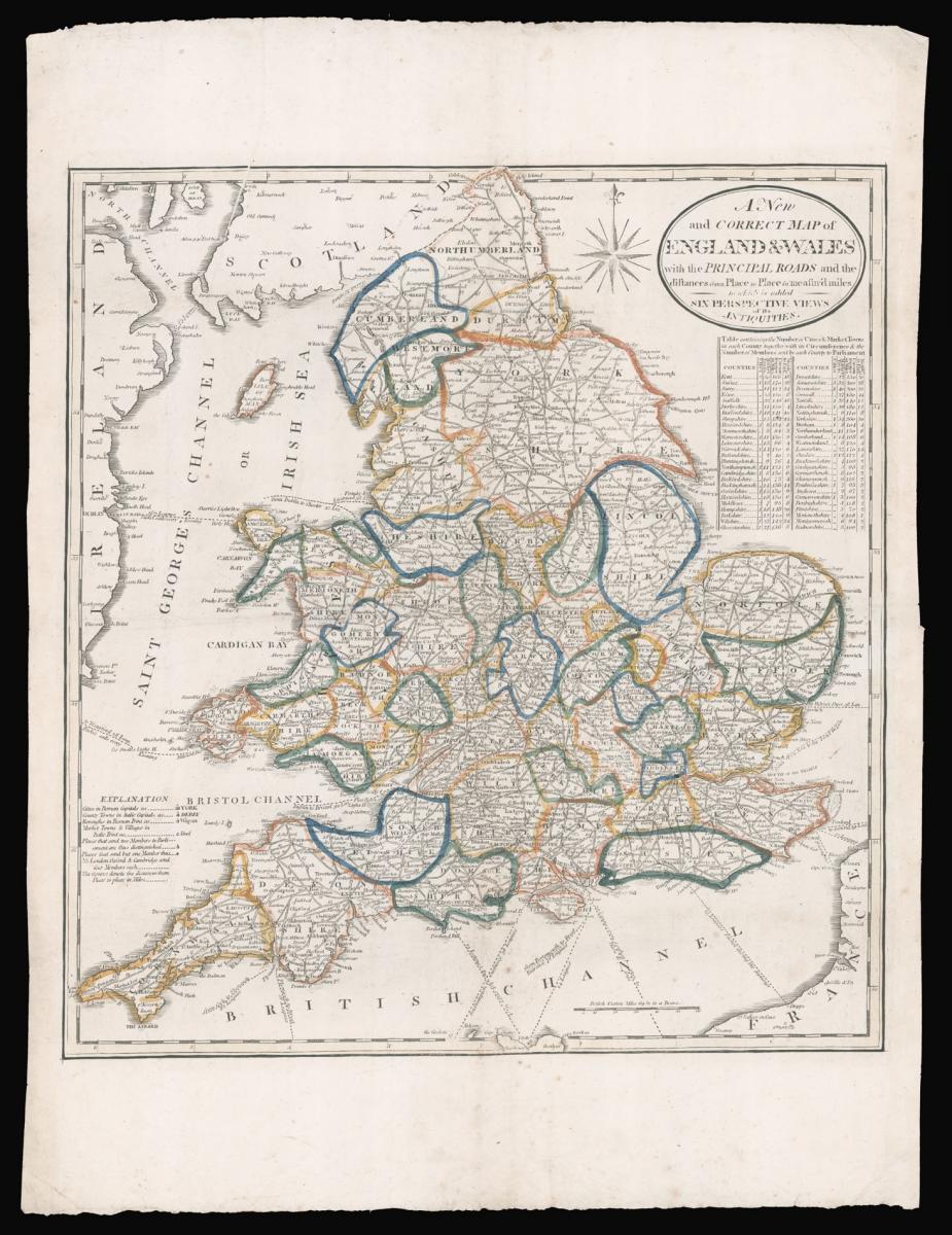
William West's rare map of England and Wales.
Title A New and Correct Map of England & Wales with the Principal Roads and the distances from Place to Place in measur'd miles to which is added Six Perspective Views of its Antiquity.
Author WEST, William.
Publication place London.
Publication date circa 1804.
Wood engraved map, fine original outline hand-colour.
Notes
The map marks cities (capital letters), county towns (capitals in italics), borough towns (title case), market towns and villages (italics), places that send two Members of Parliament (a line atop a circle), and places that send one MP (a dot); a note below states that London, Oxford, and Cambridge each send four MPs. Roads are drawn between prominent cities, towns and villages, together with their distances from each other in miles. Below the title is a table enumerating each county's cities and market towns, the county's circumference, and the number of MPs.
William West received training from the engraver and publisher James Evans in the 1780s. He would later take over the running of John Evans' (James' brother) business in partnership with John's son James. West for the rest of his career was know as a publisher of children's educational material, and only known to have published two maps, the present map of England and Wales, and a two sheet map of the world. Both of which are exceedingly rare.
We are unable to trace an other example of this state of the map. The British Library houses the only other extant example dated 1st March 1804 and with the name of William West. The present map bears on imprint.
Bibliography
BL Cartographic Items Maps CC.6.a.31.
Dimensions
510 by 470mm. (20 by 18.5 inches)Stock number
14887The BADA Standard
- Since 1918, BADA has been the leading association for the antiques and fine art trade
- Members are elected for their knowledge, integrity and quality of stock
- Our clients are protected by BADA’s code of conduct
- Our dealers’ membership is reviewed and renewed annually
- Bada.org is a non-profit site: clients deal directly with members and they pay no hidden fees


