Price
£3000.00This object is eligible for a Certificate of BADA Provenance
The BADA Standard
- Since 1918, BADA has been the leading association for the antiques and fine art trade
- Members are elected for their knowledge, integrity and quality of stock
- Our clients are protected by BADA’s code of conduct
- Our dealers’ membership is reviewed and renewed annually
- Bada.org is a non-profit site: clients deal directly with members and they pay no hidden fees
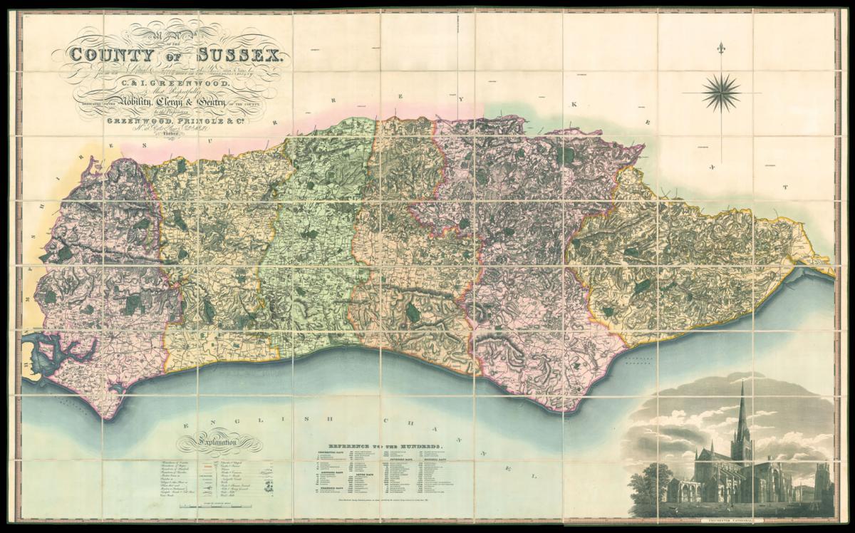
Greenwood's large-scale map of Sussex.
Title Map of the County of Sussex.
Author GREENWOOD, Christopher.
Publisher Greenwood, Pringle & Co, 13 Regent St, Pall Mall.
Publication place London.
Publication date March 24th 1825.
Large engraved map on six sheets, dissected and mounted on linen, fine original full wash colour, edged in green silk, housed in original tree calf pull-off slipcase, red morocco label to spine.
Notes
The maps by Christopher and John Greenwood set new standards for large-scale surveys. Although they were unsuccessful in their stated aim to map all the counties of England and Wales it is probably no coincidence that of the ones they missed, Buckinghamshire, Cambridgeshire, Herefordshire, Hertfordshire, Norfolk and Oxfordshire, all except Cambridgeshire were mapped by Andrew Bryant in a similar style and at the same period. From a technical point of view the Greenwoods' productions exceeded the high standards set in the previous century though without the decoration and charming title-pieces that typified large scale maps of that period.
The Greenwoods started in 1817 with Lancashire and Yorkshire and by 1831 they had covered 34 counties. Their maps were masterpieces of surveying and engraving techniques, and in view of the speed at which they were completed, their accuracy is remarkable. They mark the boundaries of the counties, hundreds and parishes, churches and chapels, castles and quarries, farmhaouses and gentlemen's seats, heaths and common land, woods, parliamentary representatives and distances between towns. The price of 3 guineas each compares with the the first edition Ordnance Survey sheets of 7s 6d, though the latter did not relate to complete counties.
Dimensions
1290 by 1880mm. (50.75 by 74 inches)Stock number
11561The BADA Standard
- Since 1918, BADA has been the leading association for the antiques and fine art trade
- Members are elected for their knowledge, integrity and quality of stock
- Our clients are protected by BADA’s code of conduct
- Our dealers’ membership is reviewed and renewed annually
- Bada.org is a non-profit site: clients deal directly with members and they pay no hidden fees