


Price
£90000.00This object is eligible for a Certificate of BADA Provenance
The BADA Standard
- Since 1918, BADA has been the leading association for the antiques and fine art trade
- Members are elected for their knowledge, integrity and quality of stock
- Our clients are protected by BADA’s code of conduct
- Our dealers’ membership is reviewed and renewed annually
- Bada.org is a non-profit site: clients deal directly with members and they pay no hidden fees
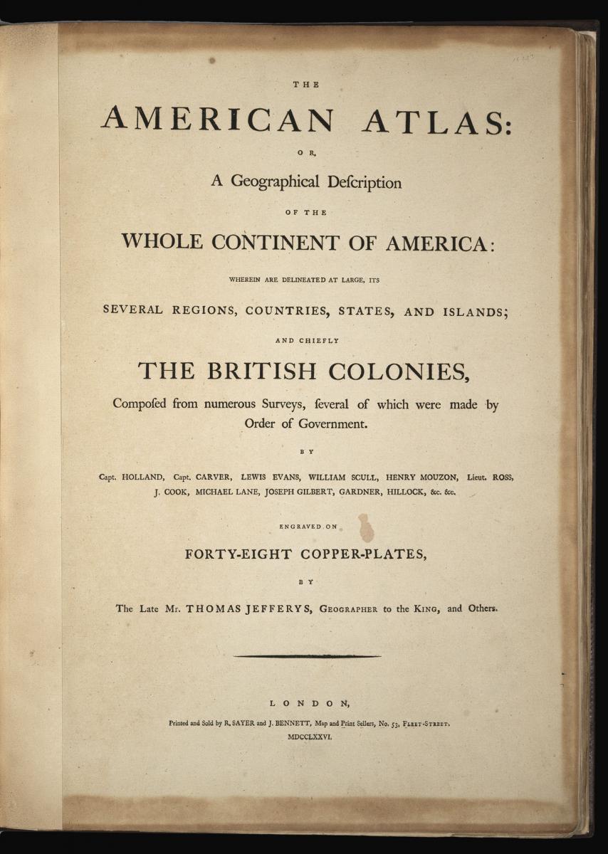
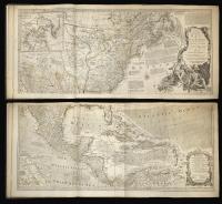
Title The American Atlas: or, A Geographical Description of the Whole Continent of America Wherein are Delineated at Large, its Several Regions, Countries, States, and Islands; and Chiefly the British Colonies ... By the Late Mr. Thomas Jefferys, Geographer to the King, and others.
Author JEFFERYS, Thomas
Publisher Robert Sayer and John Bennett
Publication place London
Publication date 1776
Second edition, early issue. Folio (570 x 410mm). Letterpress title-page and Index leaf numbered to 29. 22 fine engraved maps on 29 sheets, one full-page the others all folding or double-page by Henry Mouzon, Joshua Fry & Peter Jefferson, William Scull, Thomas Jefferys, Samuel Holland and others, all with contemporary hand-colour in outline, one with hand-colour in part.
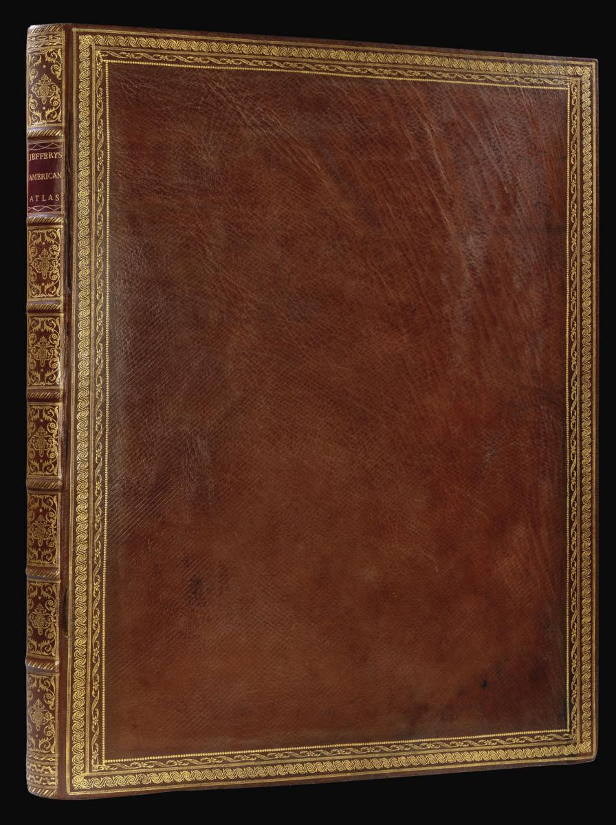
Fine binding of 18th-century diced russia, each cover with a broad border of gilt roll tools, the spine in eight compartments with seven raised bands, maroon morocco lettering-piece in one, the others decorated with fine gilt tools.
Notes
An early issue of the second edition of Jeffery's superb and important atlas of America during the Revolutionary War era. The title-page is dated 1776, but the index leaf only calls for 29 maps, rather than 30. Jeffery's edition of Pownall's "Map of the Middle British Colonies" has been replaced by the map of Quebec; most maps are dated 1775, two are dated 1774, and one 1776.
Jefferys was geographer to the Prince of Wales, later King George III, and the leading map supplier of his day. His "American Atlas" is the most important 18th-century atlas for America, described by Walter Ristow as a "geographical description of the whole continent of America, as portrayed in the best available maps in the latter half of the eighteenth century... as a major cartographic reference work it was, very likely, consulted by American, English, and French civilian administrators and military officers during the Revolution."
The atlas contains a number of seminal maps, including Braddock Mead's "A Map of the Most Inhabited Parts of New England," the largest and most detailed map of New England yet published, and Samuel Holland's "The Provinces of New York and New Jersey." Holland was surveyor for the northern American colonies. Joshua Fry and Peter Jefferson's "A Map of the Most Inhabited part of Virginia" is the best colonial map of the Chesapeake region. Lieut. Ross's "Course of the Mississipi" is the first map of that river based on English sources.
The maps are:
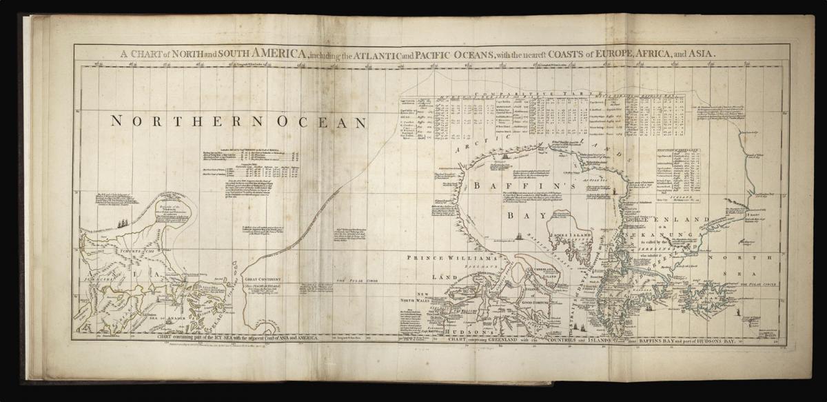
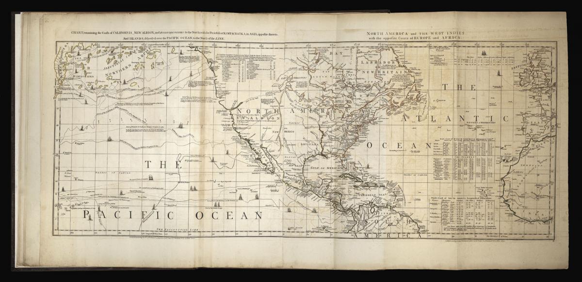
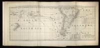
1, 2, 3. Braddock Mead (alias John Green). "A Chart of North and South America, including the Atlantic and Pacific Oceans..." Published 10th June 1775. Six sheets joined into three.
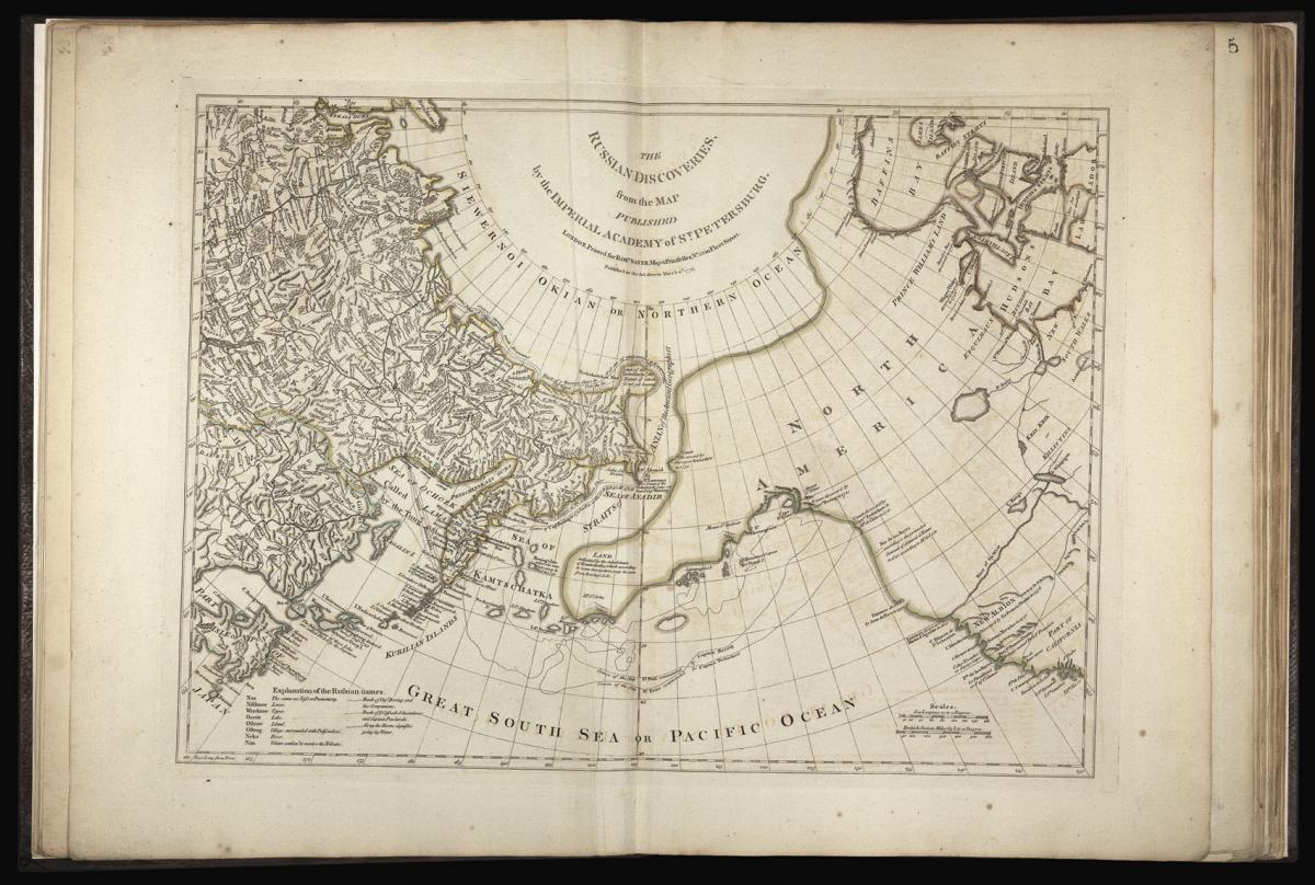
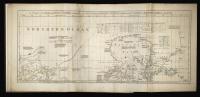
4. Imperial Academy of St. Petersburg. "The Russian Discoveries." Published 2 March 1775. One sheet.
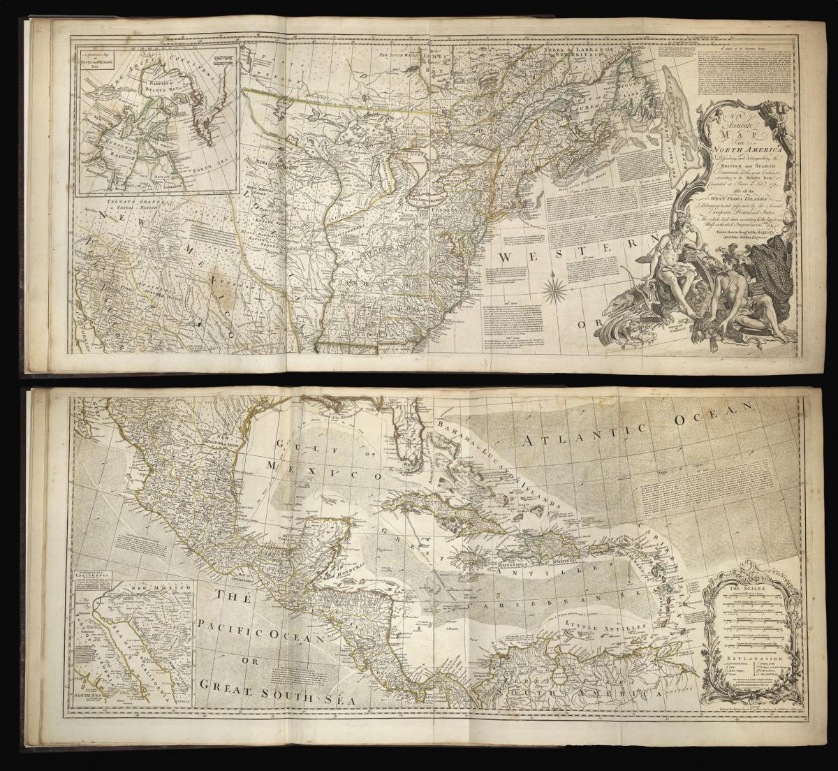
5, 6. Emanuel Bowen and John Gibson. "An Accurate Map of North America Describing and distinguishing the British and Spanish Dominions." Published 2 July 1775. Four sheets joined into two.
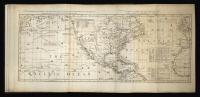
7. Thomas Jefferys. "North America from the French of Mr. D'Anville." Published 10 June 1775. One sheet.
8. Samuel Dunn. "A Map of the British Empire in North America." Published 10 January 1774. One sheet.
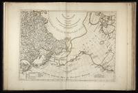
9. Thomas Jefferys. "An Exact Chart of the River St. Laurence from Fort Frontenac to the Island of Anticosti." Published 25 May 1775. Two sheets joined into one.
10. Sayer and Bennett. "A Chart of the Gulf of St. Laurence..." Published 25 March 1775. One sheet.
11. "A Map of the Island of St. John in the Gulf of St. Laurence." Published 6 April 1775. One sheet.
12. James Cook and Michael Lane. "A General Chart of the Island of Newfoundland." Published 10 May 1775. One sheet.
13. "A Chart of the Banks of Newfoundland." Published 25 March 1775. One sheet.
14. Thomas Jefferys. "A New Map of Nova Scotia and Cape Breton Island with the adjacent parts of New England and Canada." Published 15 June 1775. One sheet.
15, 16. Braddock Mead (alias John Green). "A Map of the Most Inhabited Part of New England." Published 29 November 1774. Four sheets joined into two.
17. Samuel Holland. "The Provinces of New York and New Jersey; with part of Pensilvania and the Province of Quebec." Published 16 June 1775. Two sheets joined into one.
18. A New Map of the Province of Quebec. 16th February, 1776
19. William Scull. "A Map of Pennsylvania Exhibiting not only the Improved Parts of the Province but also its Extensive Frontiers." Published 10 June 1775. Two sheets joined into one.
20, 21. Joshua Fry and Peter Jefferson. "A Map of the Most Inhabited Part of Virginia containing the whole Province of Maryland with Part of Pensilvania, New Jersey and North Carolina." N.d. Four sheets joined into two.
22, 23. Henry Mouzon. "An Accurate Map of North and South Carolina with their Indian Frontiers." Published 30 May 1775. Four sheets joined into two.
24. Thomas Jefferys. "The Coast of West Florida and Louisiana." Published 20 February 1775. Two sheets joined into one.
25. Lieut. Ross. "Course of the River Mississipi... Taken from the Expedition to Illinois in the latter end of the year 1765." Published 1 June 1775. Two sheets joined into one.
26. Thomas Jefferys. "The Bay of Honduras." Published 20 February 1775. One sheet.
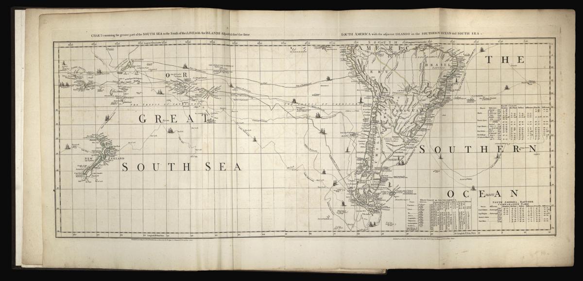
27, 28. J.B.B. D'Anville. "A Map of South America..." Published 20 September 1775. Four sheets joined into two.
29. Cruz Cano, et al. "A Chart of the Straits of Magellan." Published 1 July 1775. One sheet.
Thomas Jefferys (1719-1771) published some of "the most important eighteenth-century maps of the Americas, a series given cohesion and impetus by the preliminary hostilities and eventual outbreak of the Seven Years' War. Among many individual works of note were Joshua Fry's and Peter Jefferson's 1751 survey of Virginia, engraved and published by Jefferys in 1753, and Joseph Blanchard's and Samuel Langdon's New Hampshire (1761), the first published map of the state.
The culmination of this concentration of work was the atlas published in association with Robert Sayer as 'A General Topography of North America' in 1768. Posthumous collections were published by Sayer in 1775 as 'The American Atlas', 'The North-American Pilot', including important charts by James Cook, and 'The West-India Atlas', for which a collection of working drafts survives in the British Library" (DNB).
Bibliography
Harley, 'Imago Mundi' XX pp. 27-48; Howes J81; Phillips Atlases 3659a; Pritchard & Taliaferro p. 211; Ristow, Introduction to the facsimile edition (Amsterdam, Theatrum Orbis Terrarum, 1976); Sabin 35953; Shirley, BL T.JEF 2c; Streeter I 72.
Stock number
12841The BADA Standard
- Since 1918, BADA has been the leading association for the antiques and fine art trade
- Members are elected for their knowledge, integrity and quality of stock
- Our clients are protected by BADA’s code of conduct
- Our dealers’ membership is reviewed and renewed annually
- Bada.org is a non-profit site: clients deal directly with members and they pay no hidden fees


