

Price
£1800.00This object is eligible for a Certificate of BADA Provenance
The BADA Standard
- Since 1918, BADA has been the leading association for the antiques and fine art trade
- Members are elected for their knowledge, integrity and quality of stock
- Our clients are protected by BADA’s code of conduct
- Our dealers’ membership is reviewed and renewed annually
- Bada.org is a non-profit site: clients deal directly with members and they pay no hidden fees
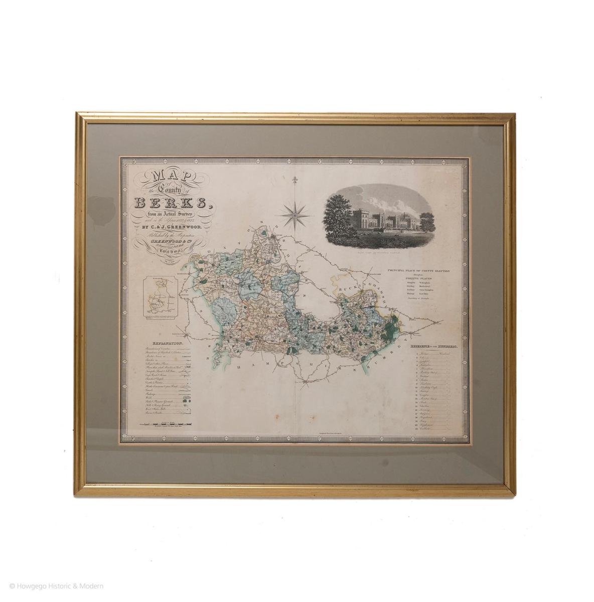
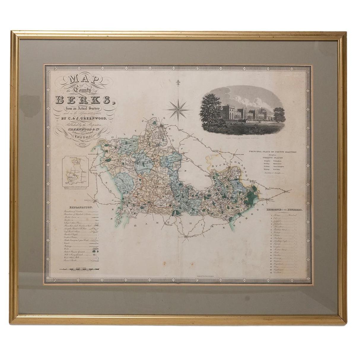
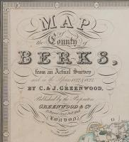
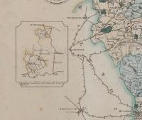
Map of Berkshire by C & J Greenwood, circa 1829.
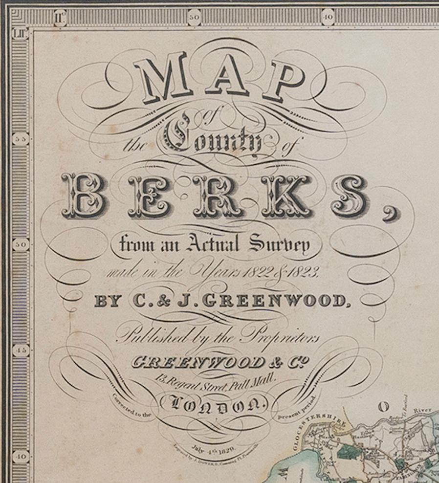
A Map of the County of Berkshire from an Actual Survey made in the Years 1822 & 1823 by C & J Greenwood.
Published by the Proprietors Greenwood & Co, 13 Regent Street, Pall Mall, London, July 4th 1829.
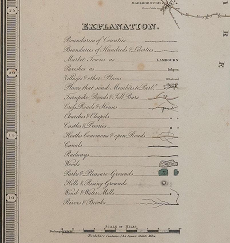
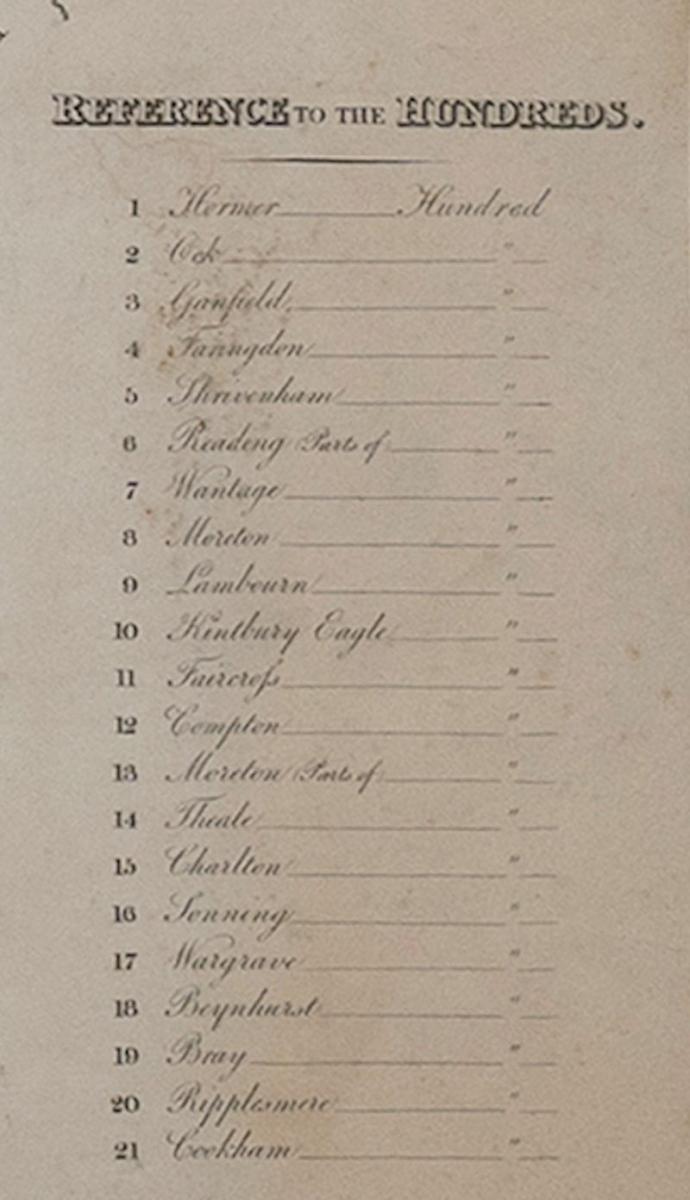
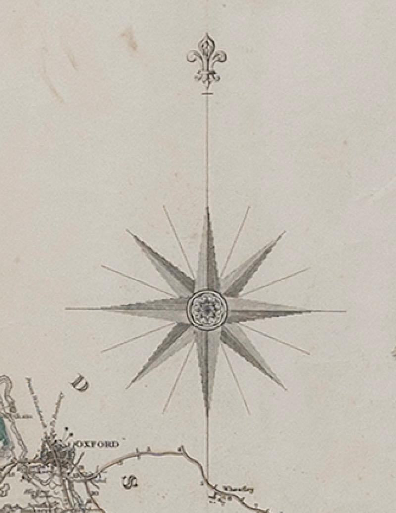
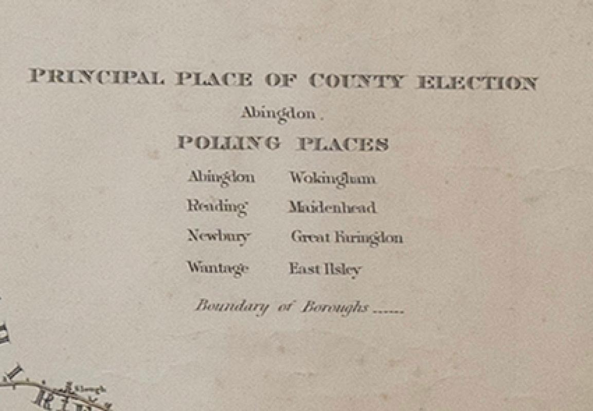
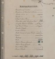
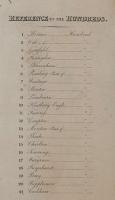
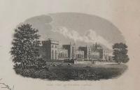
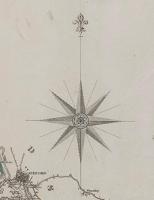
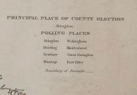
A large coloured map of Berkshire: with a black and white vignette of the East View of Windsor Castle top right; a list of Polling Places below; a list of the Hundreds bottom right; a key bottom left; and title top left.
Artist : Engraved by J. Dower, 6, Cumming Place, Pentonville.
Measures: 86cm, 34" long.
Dimensions
Height: 86 cm (33.86 in), Width: 76 cm (29.93 in), Depth: 3 cm (1.19 in)Condition report
Good condition. Wear consistent with age and use.The BADA Standard
- Since 1918, BADA has been the leading association for the antiques and fine art trade
- Members are elected for their knowledge, integrity and quality of stock
- Our clients are protected by BADA’s code of conduct
- Our dealers’ membership is reviewed and renewed annually
- Bada.org is a non-profit site: clients deal directly with members and they pay no hidden fees