

Price on application
This object is eligible for a Certificate of BADA Provenance
The BADA Standard
- Since 1918, BADA has been the leading association for the antiques and fine art trade
- Members are elected for their knowledge, integrity and quality of stock
- Our clients are protected by BADA’s code of conduct
- Our dealers’ membership is reviewed and renewed annually
- Bada.org is a non-profit site: clients deal directly with members and they pay no hidden fees
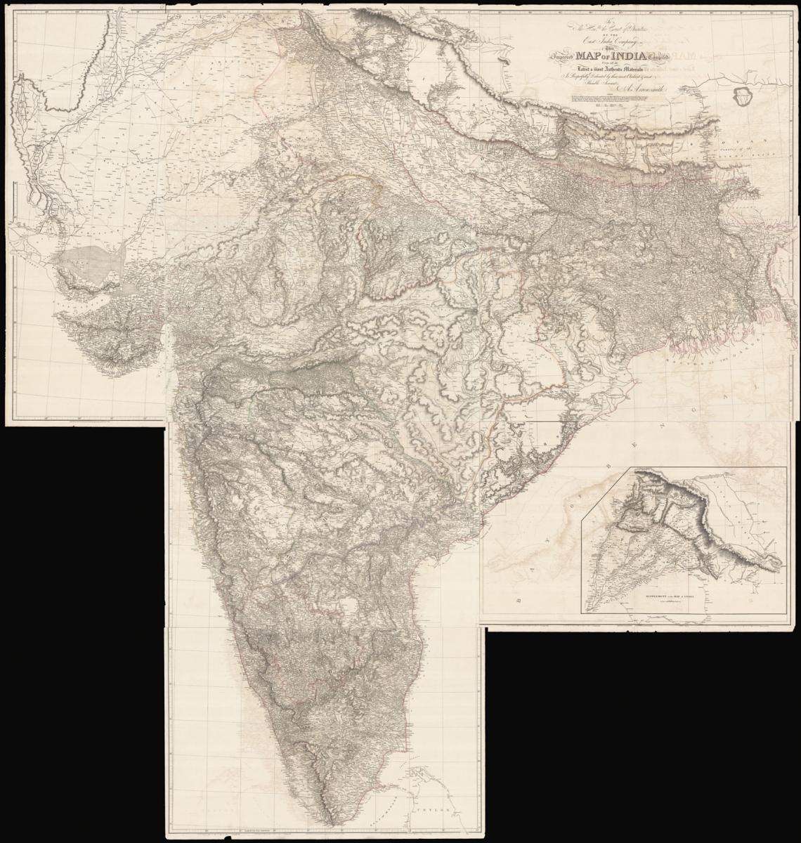
The largest map of India produced before the trigonometrical survey.
Title To The Hon[oura]ble the Court Directors of the East India Company This Improved Map of India Compiled from all the Latest & Materials Is Respectfully Dedicated by their most Obedient & most Humble Servant A. Arrowsmith.
Author ARROWSMITH, Aaron.
Publisher Published by A. Arrowsmith, Hydrographer to his Majesty, No. 10 Soho Square.
Publication place London.
Publication date 2nd January, 1816.
Large engraved map, on nine sheets, original outline hand-colour, some off-setting.
Notes
Arrowsmith's monumental wall map of India on nine sheets.
With the growing influence of the British in India at the end of the eighteenth century, the need for an up-to-date general map of the sub-continent grew. The first Governor-General, Warren Hastings, employed Major Rennell who, in 1779, published his famous Bengal Atlas, followed up in 1788 by his map of India.
The map itself was based upon D'Anville's map of 1752, though enriched by much new material, supplied by the numerous "route surveys" carried out by the army.
As these "route surveys" began to become more numerous and accurate the need for a new general map of India soon became apparent. In 1816 Aaron Arrowsmith published his Map of India in nine sheets, on a scale of sixteen miles to an inch, which was the last great general map based on route surveys.
His subsequent Atlas of South India, published in 1822, was based upon the trigonometrical surveys of Colonel Lambton, filled in by the officers of the Madras Institute.
Bibliography
BLMC Maps K.Top.115.17.2.2 TAB.END.; Maps of India 269, Handbook to the special loan collection of scientific apparatus 1876. Prepared at the request of the Lords of the Committee of council on education, London, Chapman & Hall.
Dimensions
2400 by 2670mm (94.5 by 105 inches)Stock number
15255The BADA Standard
- Since 1918, BADA has been the leading association for the antiques and fine art trade
- Members are elected for their knowledge, integrity and quality of stock
- Our clients are protected by BADA’s code of conduct
- Our dealers’ membership is reviewed and renewed annually
- Bada.org is a non-profit site: clients deal directly with members and they pay no hidden fees


