Price
£2350.00This object is eligible for a Certificate of BADA Provenance
The BADA Standard
- Since 1918, BADA has been the leading association for the antiques and fine art trade
- Members are elected for their knowledge, integrity and quality of stock
- Our clients are protected by BADA’s code of conduct
- Our dealers’ membership is reviewed and renewed annually
- Bada.org is a non-profit site: clients deal directly with members and they pay no hidden fees
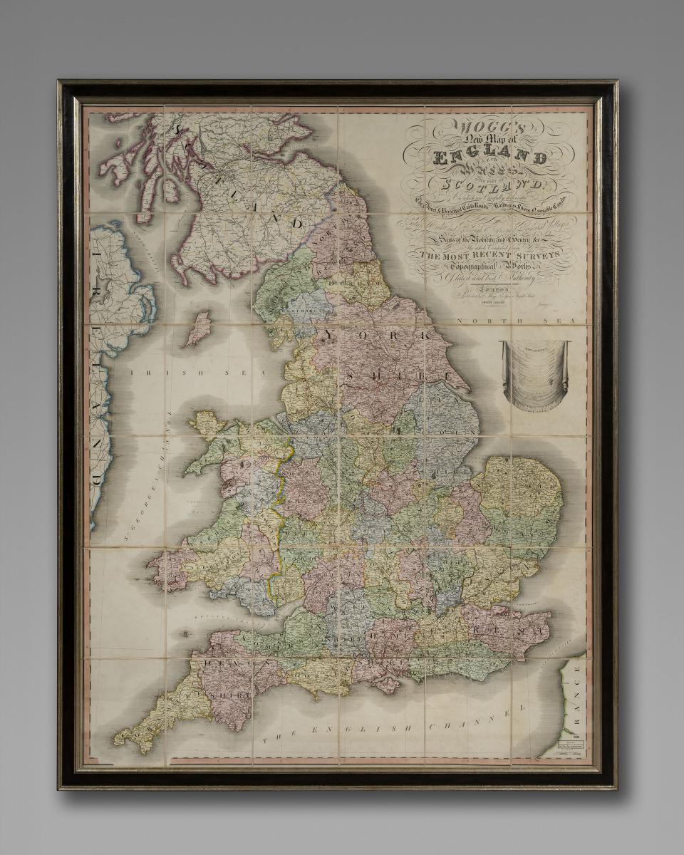
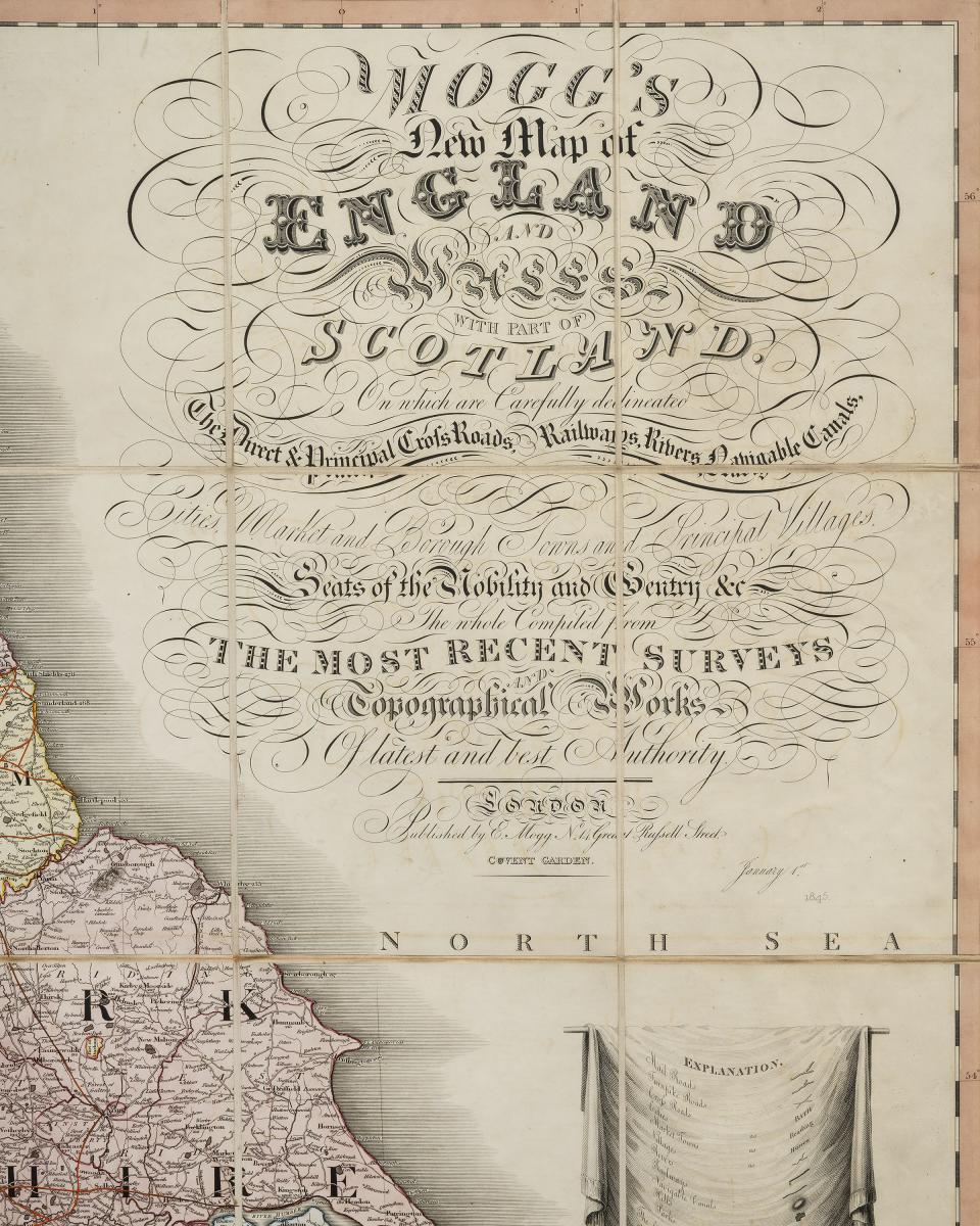
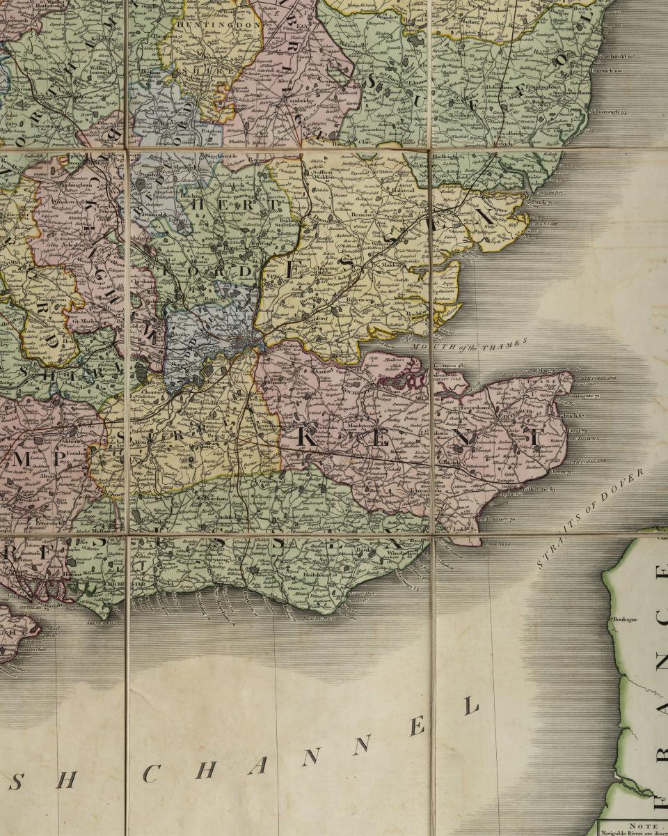
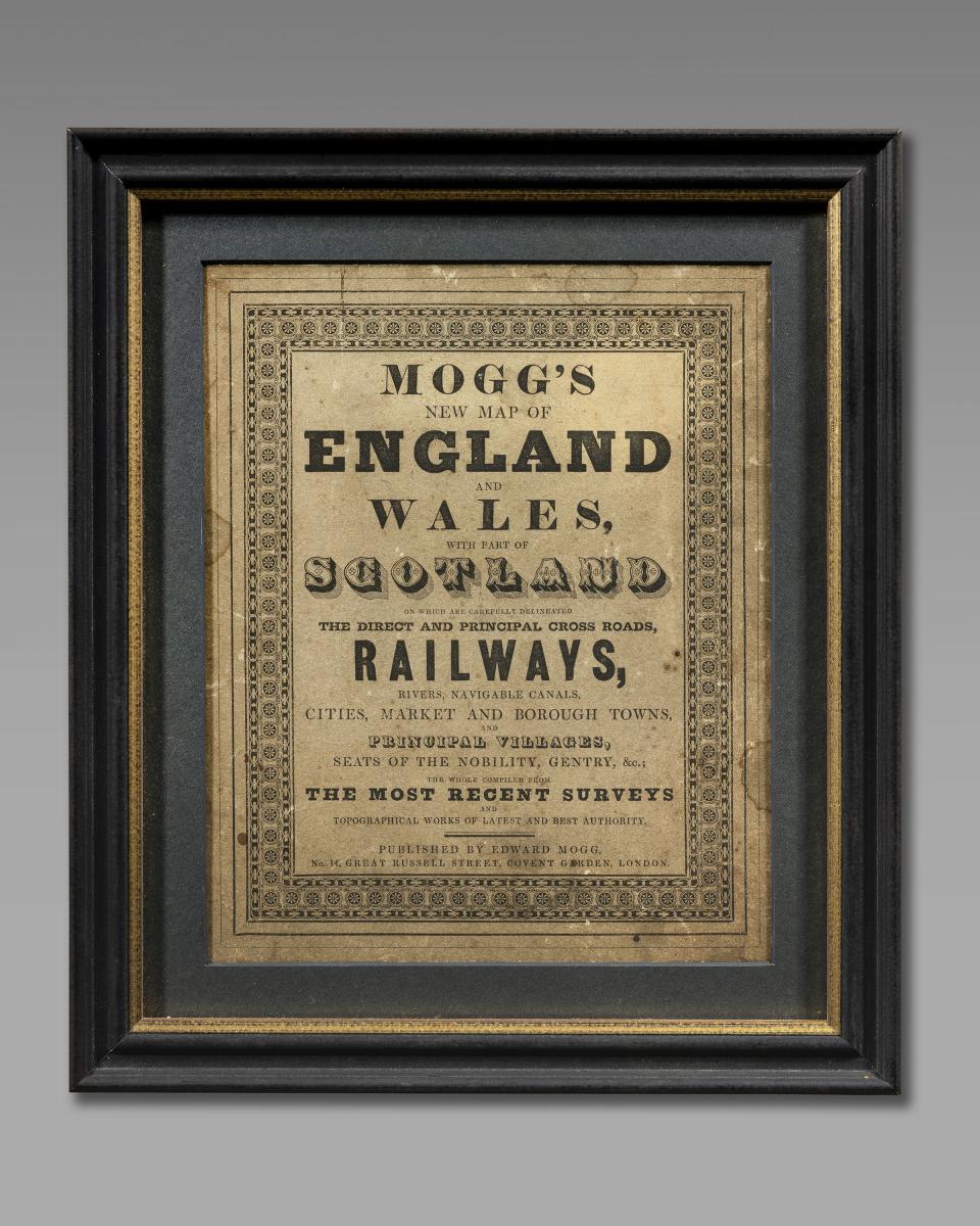
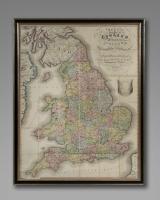
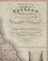
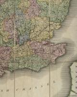
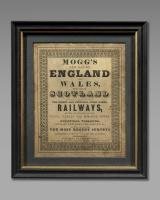
Large 19th century map of England and Wales by Edward Mogg.
Map on linen by Mogg 1845. Published Edward Mogg 14, Great Russell St. Covent Garden. Framed and glazed .
Mogg's new map of the most recent surveys and topographical works, of the latest and best authority. England and Wales, with a part of Scotland and Ireland are shown.
Framed and glazed measures 145cm x 116.5cm
This folding map is now unfolded, with 36 sections hand-coloured prints all mounted onto linen.
I have kept the original slip case, which is now framed and mounted. This measures 27cm x 23cm
The whole is now complete.
This map carefully delineated the direct and principal crossroads, rivers, navigable canals, cities, market, and Borough Towns along with principal villages, seats of the nobility, gentry &c.;
Dated 1845.
Dimensions
Width 116.50cm Height 145cmCondition report
GoodStock number
17944630Open: Tuesday to Friday 10am – 5pm, Saturday 10am – 4pm. Closed: Sundays and Mondays.
The BADA Standard
- Since 1918, BADA has been the leading association for the antiques and fine art trade
- Members are elected for their knowledge, integrity and quality of stock
- Our clients are protected by BADA’s code of conduct
- Our dealers’ membership is reviewed and renewed annually
- Bada.org is a non-profit site: clients deal directly with members and they pay no hidden fees