Sold
This object is eligible for a Certificate of BADA Provenance
The BADA Standard
- Since 1918, BADA has been the leading association for the antiques and fine art trade
- Members are elected for their knowledge, integrity and quality of stock
- Our clients are protected by BADA’s code of conduct
- Our dealers’ membership is reviewed and renewed annually
- Bada.org is a non-profit site: clients deal directly with members and they pay no hidden fees
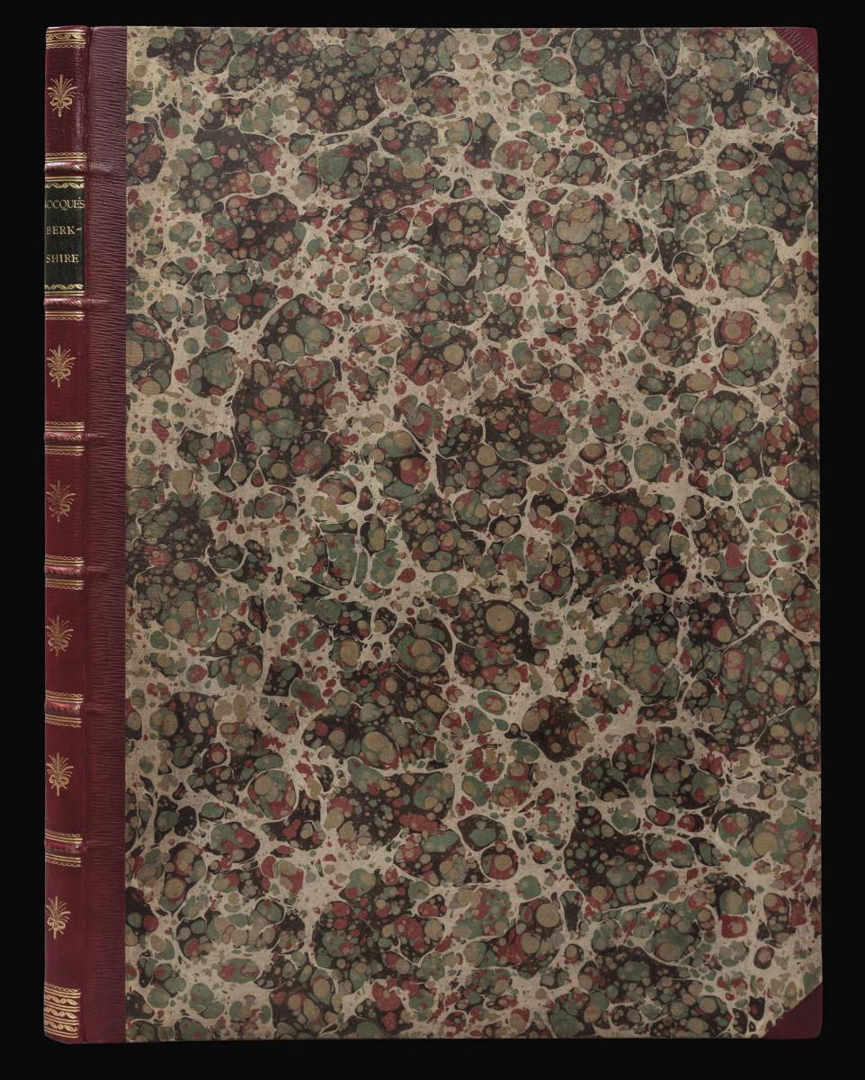
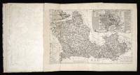
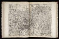
John Rocque's large-scale map of Berkshire.
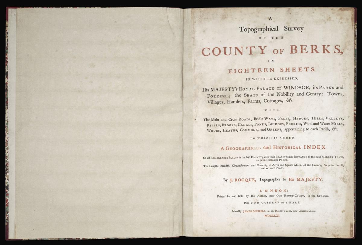
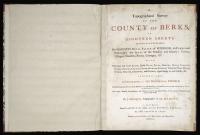
Title [Berkshire] A Topographical Survey of the County of Berks, in Eighteen Sheets. In which is expressed His Majesty's Royal Palace at Windsor, its Parks and Forrest; the Seats of the Nobility and Gentry; Towns, Villages, Hamlets, Farms, Cottages, &c. with the Main and Cross Roads, Bridle Ways, Pales, Hedges, Hills, Valleys, Rivers, Brooks, Canals, Ponds, Bridges, Ferries, Wind and Water Mills, Woods, Heaths, Commons, and Greens, appertaining to each Parish, &c.
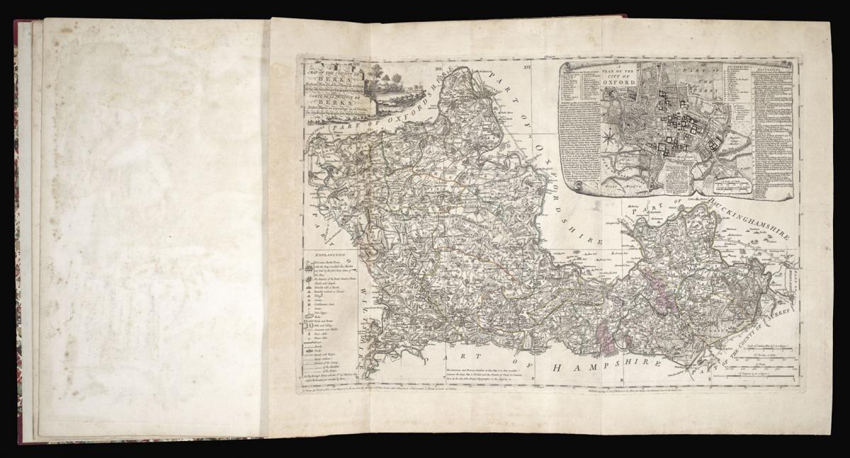
To which is added, a geographical and historical index of all remarkable places in the said county; with their bearings and distance to the next market town, or well known place. The length, breadth, circumference, and content, in acres and square miles,of the county, the Windsor Forest, and of each Parish. [together with] A Map of the County of Berks reduced from an actual survey in 18 sheets, by the late John Rocque Topographer to His Majesty, 1762.
Author ROCQUE, John.
Publisher Printed for and Sold by the Author, near Old Round-Court, in the Strand.
Publication place London.
Publication date 1761 [and] 1762.
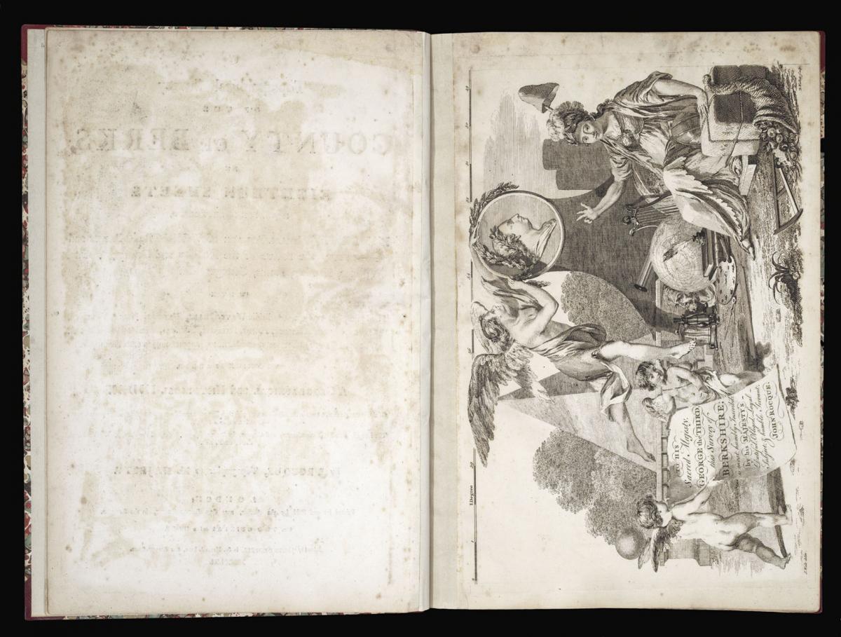
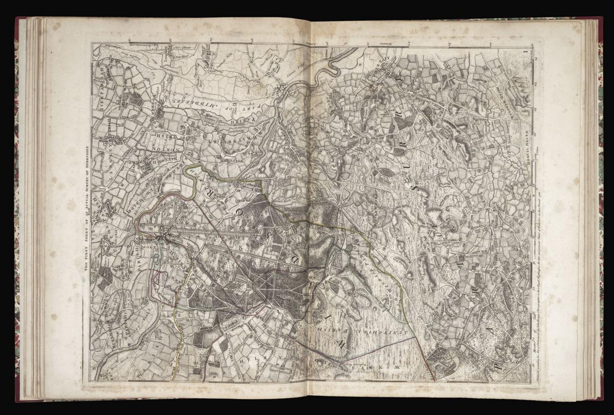
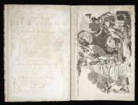
Folio (530 by 375mm), key map, title, engraved frontispiece (which is sheet fifteen of the map), a description of the county with a reference to the numbering of each sheet of the map, a 12-page index of the towns, villages etc., and 17 engraved maps, which together with the frontispiece form the large-scale map, later half-calf over marbled paper boards.
Notes
The comprehensive title page provides a full description of the detail included in this magnificent map, engraved by R. Benning and L. F. Deharme, which includes, unusually, detailed survey of parts of the surrounding counties and which reflects Rocque's stated intention to produce similar surveys of Buckinghamshire and Oxfordshire though neither materialised. The letter-press preliminaries are of particular interest commencing with the description of the ancient history of the county with conjecture as to the derivation of its name.
It also describes in detail the extent of the county with the rivers and major towns and indicates that nine members are sent to Parliament. It is also interesting to note "the high price which land bears here, more than in other parts equally near London". There is a "Reference to show in what Manner each plate is numbered". There is also an eleven page "Index of Towns, Villages, Seats of the Nobility and Gentry, Places of Antiquity, and Historical Remarks, with the Bearings and Distances to the next Market Town or Well-known Place, In order to make the Topographical Map of Berkshire useful and agreeable".
The large running title-piece on the map is in both English and French and reflects Rocque's Huguenot extraction. He came to England early in the eighteenth century and his cartographic achievements resulted in his appointment as Topographer to George III, to whom this map is dedicated. Apart from the two large plans of London he had already produced fine surveys of Bristol in 1750, Shropshire in 1752, and Middlesex in 1754 whilst he also spent some time in Ireland surveying Dublin, Cork, Kilkenny and Armagh.
On his death in 1762 his widow, Mary Ann Rocque, published a map of the county, which though squared off as a key to the large-scale survey is a fine map in its own right. It contains an interesting plan of Oxford on a scale of 300 yards to the inch. Rocque was also resonsible for other cartographical work, including a small English county atlas that went into many editions from 1753. It is, however, for his superb large-scale maps that he achieved most fame. His map of Berkshire is the largest of his county surveys.
Stock number
14994The BADA Standard
- Since 1918, BADA has been the leading association for the antiques and fine art trade
- Members are elected for their knowledge, integrity and quality of stock
- Our clients are protected by BADA’s code of conduct
- Our dealers’ membership is reviewed and renewed annually
- Bada.org is a non-profit site: clients deal directly with members and they pay no hidden fees