Price
£3500.00This object is eligible for a Certificate of BADA Provenance
The BADA Standard
- Since 1918, BADA has been the leading association for the antiques and fine art trade
- Members are elected for their knowledge, integrity and quality of stock
- Our clients are protected by BADA’s code of conduct
- Our dealers’ membership is reviewed and renewed annually
- Bada.org is a non-profit site: clients deal directly with members and they pay no hidden fees
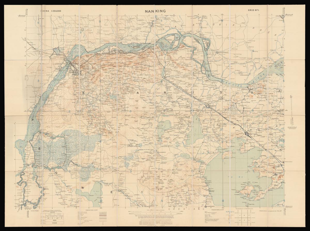
General Staff map of Nanking.
Title Map of Nanking Compiled, drawn and printed at the War Office, 1927.
Author War Office, Geographical Section, General Staff.
Publisher War Office, Geographical Section, General Staff.
Publication date 1927.
Coloured lithograph map dissected into 32 (4 by 8) sections mounted on linen.
Scale 1:250,000.
Notes
Nanking in 1927 was a treaty port located on the southern shores of the Yangtze River. Because the foreign interests in China were largely American and European, squadrons of foreign naval vessels were stationed along the Yangtze to protect their citizens doing business at the treaty ports. The British Royal Navy operated the China Station under Rear Admiral Sir Reginald Tyrwhitt and the United States Navy the Yangtze Patrol; both lasted for around 80 years until World War II.
Dimensions
745 by 995mm. (29.25 by 39.25 inches)Stock number
15017The BADA Standard
- Since 1918, BADA has been the leading association for the antiques and fine art trade
- Members are elected for their knowledge, integrity and quality of stock
- Our clients are protected by BADA’s code of conduct
- Our dealers’ membership is reviewed and renewed annually
- Bada.org is a non-profit site: clients deal directly with members and they pay no hidden fees