

Price on application
This object is eligible for a Certificate of BADA Provenance
The BADA Standard
- Since 1918, BADA has been the leading association for the antiques and fine art trade
- Members are elected for their knowledge, integrity and quality of stock
- Our clients are protected by BADA’s code of conduct
- Our dealers’ membership is reviewed and renewed annually
- Bada.org is a non-profit site: clients deal directly with members and they pay no hidden fees
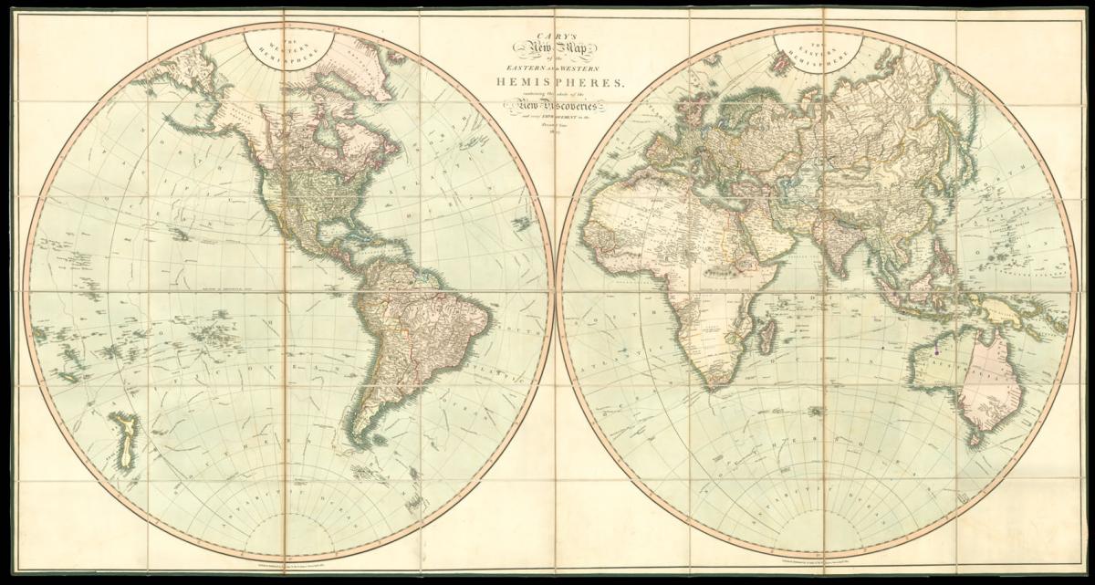
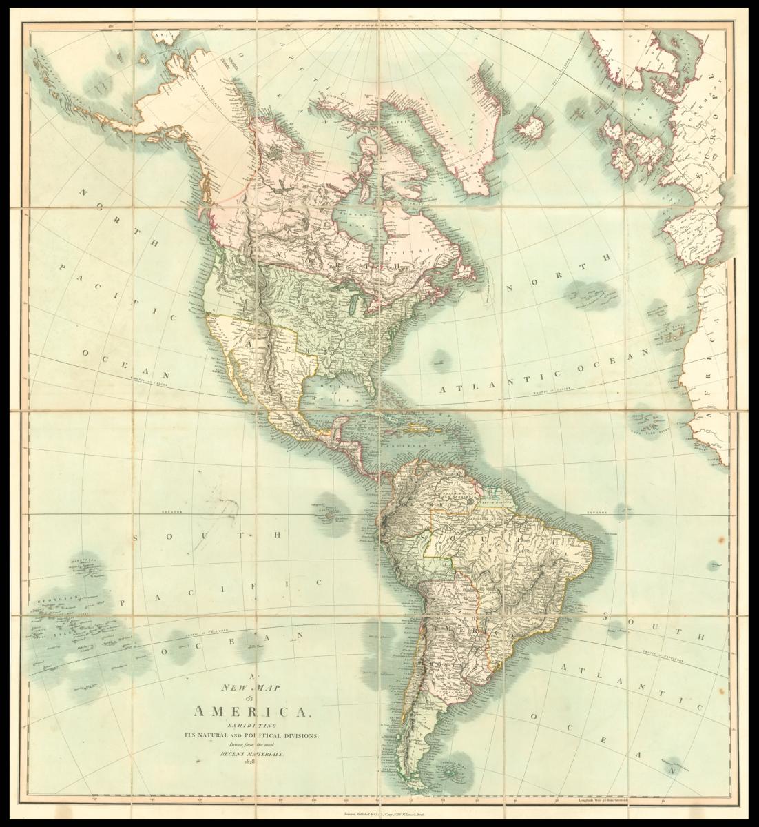
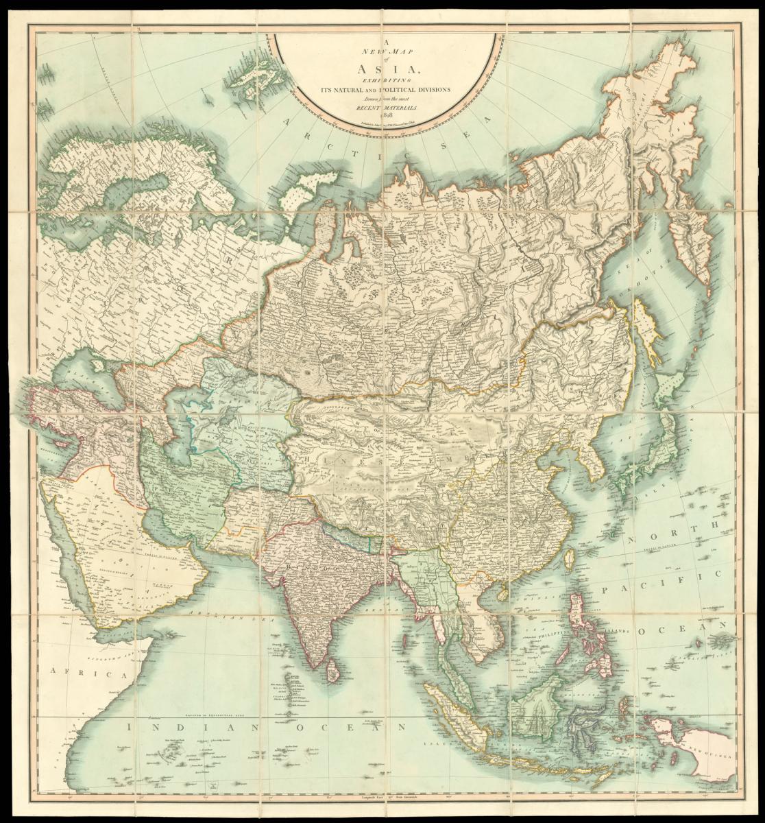
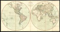
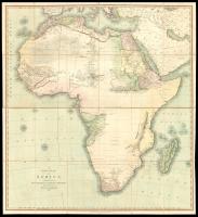
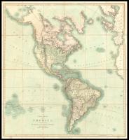
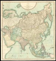
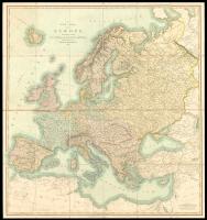
Cary's rare wall maps of the world and four continents.
Title [World and four continents] Cary's New Map of the Eastern and Western Hemisphere, containing the whole of the New Discoveries, and every Improvement to the Present time 1827; A New Map of Africa Exhibiting Its natural and Political Divisions Drawn from the most recent materials. 1828; A New Map of Europe exhibiting Its Natural and Political Divisions: Drawn from the most Recent Materials. 1828; A New Map of Asia, Exhibiting It's Natural and Political Divisions Drawn from the Most Recent Materials 1828; A New Map of America, Exhibiting It's Natural and Political Divisions Drawn from the Most Recent Materials. 1828.
Author CARY, John.
Publisher Published by J. Cary, No.86 St. James's Street.
Publication place London.
Publication date Jan.y, 1st, 1827 & 1828.
Set of five hand-coloured engraved maps, dissected and mounted on linen, each folding into original green paper slipcase, with publisher's labels, rubbed.
Notes
Rare set of John Cary's four sheet world map together with his four sheet maps of the continents.
John Cary (1754-1835) was a London based cartographer active in the early part of the 19th century. Ronald Vere Tooley, the prominent English map historian, writes of Cary, "As an engraver he was elegant and exact with fine clear lettering and great delicacy of touch." Cary began his work as an engraver, cartographer, and globe maker in 1776 with his New and Correct English Atlas.
This important atlas represented a new phase in cartography where accuracy and detail rose in prominence over the decorative embellishments of the 18th century. This change was indicative of the times when travel and commerce were expanding globally as never before.
Cary's mastery of both engraving and cartography resulted in a series of seminal works that redefined mapmaking in the early 19th century. His New Universal Atlas, published in 1808, set the standard for all cartographers who followed. Cary reissued this seminal atlas in 1811, 1819, 1824, 1828, 1833, 1836 and 1844. Cary also did considerable work on the English Ordinance Survey prior to 1805.
His cartographic work particularly inspired the Edinburgh school of cartography as represented by John Pinkerton and John Thomson. In America, Cary's work was used as the basis for Tanner's important New American Atlas. Cary's last published atlas appeared posthumously in 1844, however, by 1850 Cary's work was being carried on by his sons and other well-known cartographers including James Wyld, John Tallis & Company, and Crutchley.
Rare. We are unable to trace an institutional example of the four sheet map of the world.
Dimensions
World: 890 by 1720mm. (35 by 67.75 inches)., Continents only: 920 by 860mm (36.25 by 33.75)Stock number
1759The BADA Standard
- Since 1918, BADA has been the leading association for the antiques and fine art trade
- Members are elected for their knowledge, integrity and quality of stock
- Our clients are protected by BADA’s code of conduct
- Our dealers’ membership is reviewed and renewed annually
- Bada.org is a non-profit site: clients deal directly with members and they pay no hidden fees