
Price
£45000.00This object is eligible for a Certificate of BADA Provenance
The BADA Standard
- Since 1918, BADA has been the leading association for the antiques and fine art trade
- Members are elected for their knowledge, integrity and quality of stock
- Our clients are protected by BADA’s code of conduct
- Our dealers’ membership is reviewed and renewed annually
- Bada.org is a non-profit site: clients deal directly with members and they pay no hidden fees
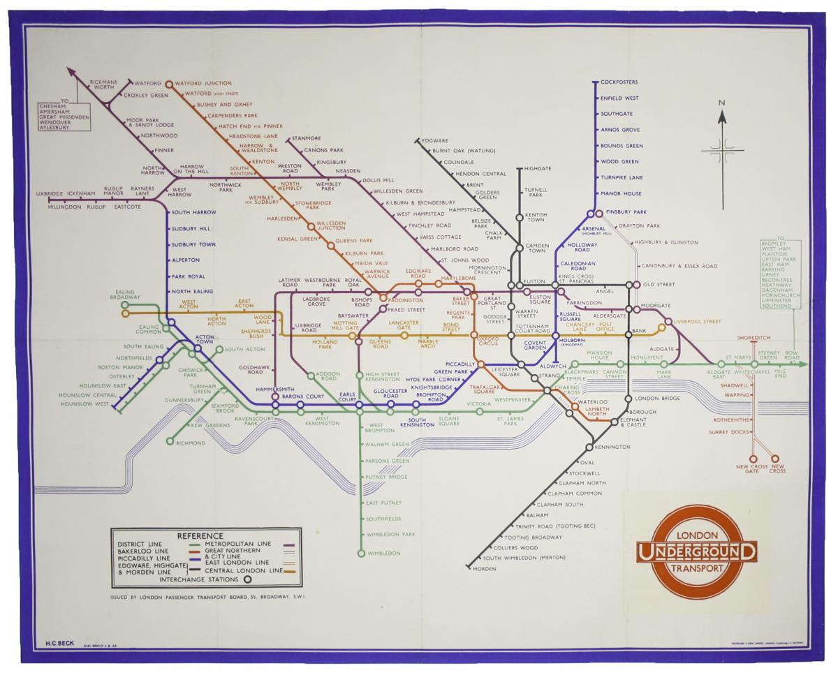
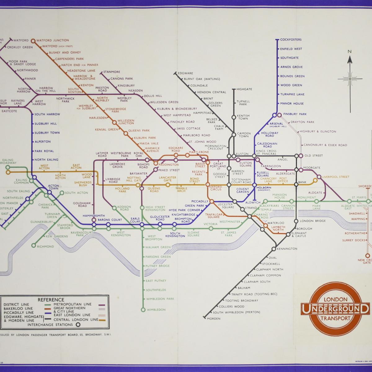
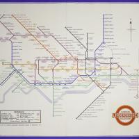
Beck’s 1933 Double-Crown Station Map
Mapmaker: Beck, Henry Charles
Publisher: Waterlow & Sons Ltd
Place of publication: London
Date of publication: 1933
Colour: original
Printed Area Measurements: 60.7 x 75.4 cm
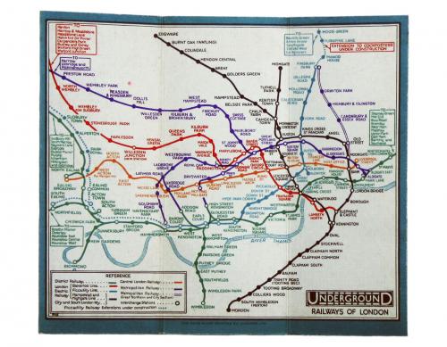
This is a good example of the second ever edition of Harry Beck’s famous diagram to appear in poster form; dated August 1933 it was the first to be printed in double-crown size. Beck’s map had first been revealed to the public in January 1933 in the form of a passenger map (a small tri-fold map, much like the ones given away in stations today).
Prior to this, maps issued by the Underground Group had been more or less geographical, although a strong design tradition evolved from the Edwardian era onward. A milestone in the mapping of the Tube, Beck’s radical design was welcomed by the (usually conservative) British public, and as a consequence it made its debut as a quad royal poster (40 x 50 inches) for station display in March 1933.
Our own map followed in the summer, printed by Waterlow and Sons in a run of 2000 copies. As the map was never intended for distribution to the general public the survival rate is extremely low. Most were displayed, and were then pasted over, scraped off walls or simply discarded when they became obsolete.
It marks a significant early stage in the evolution of the diagram. This is the poster where Beck switched his initial diamond interchange symbols for the familiar circles, and he experimented with a compass rose (which also appears on the edition of the passenger map which appeared at the same time).
One interesting aspect of the map relates to the design of the iconic London Transport bar and roundel logo. The London Passenger Transport Board (LPTB) came into being in April 1933, but was swiftly re-branded London Transport. A revised logo has been pasted on a slip of paper, bottom right, covering the clunkier LPTB logo beneath.
Condition & Materials
Double crown station wall map, 60.4 x 75.2 cm (approx 24 x 30 inches), printed in colours, a couple of short, closed tears (with no loss), minor restorations to fold intersections, recently lined on paper and linen.
Dimensions
60.7 x 75.4 cmThe BADA Standard
- Since 1918, BADA has been the leading association for the antiques and fine art trade
- Members are elected for their knowledge, integrity and quality of stock
- Our clients are protected by BADA’s code of conduct
- Our dealers’ membership is reviewed and renewed annually
- Bada.org is a non-profit site: clients deal directly with members and they pay no hidden fees